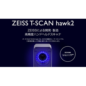
By utilizing 3D laser scanners and point clouds for on-site surveys and current condition mapping, we can solve the labor shortage problem and achieve shorter construction periods and cost reductions!
【Project Methodology and Procedures】 1. 3D measurement using a 3D laser scanner 2. Synthesis and verification of the acquired point cloud 3. Noise removal of floating objects and moving objects within the point cloud 4. Creation of current condition data 5. Modeling from the point cloud to create 3D drawings 【Deliverables】 ■ Current condition data (point cloud and 360° panoramic photos) ■ Drawing data modeled from the point cloud (compatible with 3D CAD/BIM) 【Details of Deliverables】 ■ Current condition data (point cloud) - A collection of points with X, Y, Z coordinates and RGB coordinates obtained from the camera - Allows 3D visualization on a computer, enabling viewpoint changes and cross-section creation for viewing, with high-precision dimension measurement possible ■ Current condition data (360° panoramic photos) - 360° panoramic photos taken from the position where the laser scanner was installed - Can be referenced overlaid on the point cloud, allowing for dimension measurement on the photos ■ 3D CAD drawings - CAD drawings that accurately reflect the current state of the building's structure, finishes, and equipment - High-precision piping modeling using automated piping modeling software - Created as BIM-compatible CAD data (using Revit, Rebro, Tfas, AutoCAD, Navisworks, etc.)
Inquire About This Product
basic information
Possibilities of Utilizing 3D Measurement (Point Cloud) ■ Shape and appearance confirmation of objects, dimension measurement on PC ■ Automatic modeling of piping ■ Consideration of piping routes ■ Interference simulation ■ Equipment installation simulation ■ Delivery planning ■ Temporary planning ■ 3D animation ■ Meetings using VR
Price range
Delivery Time
Applications/Examples of results
Renovation work
catalog(2)
Download All CatalogsCompany information
At Technobrain, we use 3D laser scanners for current condition surveys of renovation work and modeling from point clouds. Leveraging the technology of "3D laser scanning measurement" developed on-site, we are also engaged in the digital preservation of cultural properties. "4K + 3D shooting" is a technology that creates high-quality 3D spaces that can be viewed anytime and anywhere by capturing the entire surrounding area. It allows for free movement within a realistic space composed of 4K photographs, and VR experiences are also possible. This technology can be utilized in a wide range of fields, including current condition surveys of construction sites, promotion of cultural properties, accommodation facilities, commercial facilities, and real estate property introductions. Additionally, we create BIM-compatible construction drawings and develop VR, AR, and MR content from CAD data.


![[Case Study] 3D Laser Scanning of Cultural Heritage Measurement at Fukuoka Castle Ruins](https://image.mono.ipros.com/public/product/image/100/2000500875/IPROS33229906276700393808.jpeg?w=280&h=280)

![[Reference Example] Simulation of Safety Fence Installation](https://image.mono.ipros.com/public/product/image/00a/2001181665/IPROS10811820190111298084.jpeg?w=280&h=280)


![Plant Measurement Services and Point Cloud Data Utilization [Case Study Collection Available]](https://image.mono.ipros.com/public/product/image/bc5/2000721848/IPROS71157116316834217203.jpeg?w=280&h=280)
![[Reference Case] Layout Plan for Safety Measures within the Plant](https://image.mono.ipros.com/public/product/image/875/2001181640/IPROS84841703119831472482.jpeg?w=280&h=280)

![[For the pharmaceutical manufacturing industry] Digitizing entry management in oxygen-deficient hazardous work.](https://image.mono.ipros.com/public/product/image/20a/2001525768/IPROS14827379347403299223.jpg?w=280&h=280)
![[For the food manufacturing and beverage manufacturing industry] Digitizing the management of oxygen deficiency hazard work in tank entry.](https://image.mono.ipros.com/public/product/image/bf8/2001525769/IPROS12773363766147418267.jpg?w=280&h=280)
