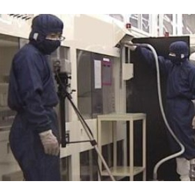
Front-facing photography using a pole camera and distortion correction system!
Our company conducts structural deterioration surveys using continuous synthetic photography. The survey method involves running a pole camera based on a pre-prepared span diagram, capturing continuous photographs while considering the overlap during synthesis. Distortion correction and photo synthesis are used to create orthophotos. This method is suitable for current condition surveys in maintenance management plans for fishing ports and harbors, as well as for river condition surveys. Please feel free to contact us if you have any requests. 【Survey Method】 <Equipment Configuration> ■ Photography Section: Camera (approximately 10 million pixels), tripod head, monitor, tripod head controller ■ Pole Trolley Section: Telescopic pole (up to 10m), electrically powered pole fixing trolley *For more details, please download the PDF or feel free to contact us.
Inquire About This Product
basic information
【Survey Method】 <Photography> ■Flat Area: Set the pole height to approximately 6m and the angle between the pole and the camera's optical axis to about 35 degrees (Under normal conditions: Capture an area of 7m x 7m in the flat area) ■Side Area: Tilt the pole horizontally and direct the camera's optical axis towards the side *For more details, please download the PDF or feel free to contact us.
Price range
Delivery Time
Applications/Examples of results
【Application】 ■Current situation survey in the maintenance and management plan of fishing ports ■Current situation survey in the maintenance and management plan of harbors ■Current situation survey of rivers *For more details, please download the PDF or feel free to contact us.
catalog(1)
Download All CatalogsCompany information
Suigai Network Co., Ltd. conducts surveys and analyses of coastal areas, as well as on-site observations and investigations, and plans and designs for ports, fishing ports, and coastal facilities. We aim to further enhance our technical support skills and provide specialized technologies to regional consultants and engineers. We also conduct tsunami simulations, asset management, and aerial photography and survey operations using multirotors, so please feel free to contact us if you have any requests.


![[Service] Investigation of Water Supply Equipment Deterioration](https://image.mono.ipros.com/public/product/image/7f5/2000501514/IPROS12811048405303961258.png?w=280&h=280)


