Plant Measurement Services and Point Cloud Data Utilization [Case Study Collection Available]
High-performance 3D scanner in use! After acquiring point cloud data, we provide a one-stop service for 3D model creation, construction drawings, manufacturing drawings, fabrication of steel structures, and renovations!
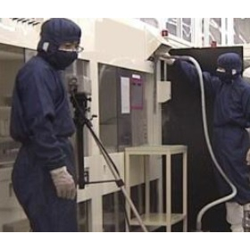
Our company utilizes 3D laser measurement and 3D CAD modeling technology to provide a one-stop service from understanding the current situation, acquiring and extracting point cloud data, creating 3D models, producing drawings, to the fabrication and renovation of steel structures. We use 3D laser scanners such as the "FARO FOCUS s150 Laser Scanner" and "Leica RTC360," along with point cloud processing software "Infi Points," enabling highly accurate measurement and modeling. Please feel free to contact us if you have any requests. 【Service Contents】 ■ Plant 3D Measurement ■ Drawing of various plans and fabrication drawings ■ Creation of 2D drawings from various structures in 3D ■ Fabrication of steel structures ■ Renovation work, etc. Okayama Prefecture, Kurashiki City, Mizushima Okayama Prefecture 3D Scanner *For more details, please download the PDF or feel free to contact us.

Inquire About This Product
basic information
【Solutions to Such Concerns】 ■ I want to carry out equipment renovation work, but I don't have the drawings. ■ I thought about measuring by hand, but the curves and twists of the measurement target are complex, making it impossible to measure accurately. ■ The work area is in a high location where it is impossible to set up a foothold. ■ High temperatures, dust, and other factors place a significant burden on workers. ■ While it is visually accessible, equipment and other factors prevent people from walking into the measurement target area. *For more details, please download the PDF or feel free to contact us.
Price range
Delivery Time
Applications/Examples of results
For more details, please download the PDF or feel free to contact us.
catalog(2)
Download All Catalogs

Company information

Our company conducts business using 3D laser scanning, 3D walking, and drone technology. In our plant measurement services, we provide a comprehensive system from scanning to 3D modeling for the creation of construction drawings, manufacturing drawings, and various reports. Additionally, for smaller projects, we can also handle on-site installation. In forest measurement, we offer information services for smart forestry. We derive information such as the location of standing trees, diameter at breast height, tree height, volume, and terrain information, and present the acquired data through viewers and reports. We prioritize our customers' perspectives and aim to provide high-quality services. Please feel free to contact us with any requests. We also welcome inquiries for demonstrations.
![Are you able to utilize point cloud data? [Plant measurement services and case studies available]](https://image.mono.ipros.com/public/product/image/72f/2000678006/IPROS38188086763124131333.jpeg?w=280&h=280)
![[Use Case] Plant Measurement Using 3D Laser Scanners](https://image.mono.ipros.com/public/product/image/891/2000700198/IPROS78462420630877042006.png?w=280&h=280)
![[Use Case] Error Verification of Drones and Fixed Scanners](https://image.mono.ipros.com/public/product/image/3ba/2000700202/IPROS58798495904648000569.png?w=280&h=280)
![[Laser Scanner and Point Cloud Utilization Case] Pedestrian Bridge Maintenance Management](https://image.mono.ipros.com/public/product/image/751/2000700209/IPROS90962773850582449477.png?w=280&h=280)
![Plant Measurement Services and Point Cloud Data Utilization [Case Studies and Technical Materials Available]](https://image.mono.ipros.com/public/product/image/ffe/2000801198/IPROS75000606592475400305.png?w=280&h=280)