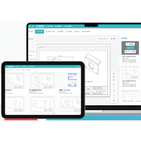
Creation of a 3D terrain model
APS-ZE is software for creating and loading 3D terrain models. It integrates route data and terrain models planned with APS-MarkIV, APS-RailBIM, and others, allowing for 3D model visualization, making it essential for BIM/CIM and 3D design.

Inquire About This Product
basic information
● Support for BIM/CIM and i-Con ● Support for J-LandXML ● Capable of creating soil layer data ● Able to reference National Geographic Institute tile photos and load aerial photos that match the location of the current topographic map ● Compatible with Web Mercator ● Capable of displaying base map information and numerical elevation models (5m/10m mesh) ● Easy to import current vector plans and assign heights ● Capable of assigning heights not only to contour lines but also to boundary lines, roads, rivers, and other slope lines ● Supports reading and exporting of geological boundary surfaces ● Significantly reduces input workload through automatic connection functionality ● The three-dimensional terrain allows for confirmation of current cross-sections at arbitrary polyline positions and calculation of cross-sectional and plan areas ● For areas without input elevation, the "height suppression function" can be used to enable cross-section drawing and repurposing as terrain for peiroke only where elevation is available ● For more details, please contact us or refer to the catalog.
Price information
Please feel free to contact us.
Delivery Time
Applications/Examples of results
Please feel free to contact us.
catalog(1)
Download All Catalogs
Company information

MTC was established in 1984 as a software production and sales company, and since then, we have provided numerous package software (APS-21 series) primarily focused on civil engineering design in the construction industry, accumulating experience and achievements. The construction industry is undergoing a significant transformation. On construction sites, we are embarking on "i-Construction," which utilizes ICT throughout all processes from surveying/designing to construction and maintenance management to enhance productivity. We feel that our expected role in the fields of BIM (Building Information Modeling) and CIM (Construction Information Modeling/Management), which aim to improve the efficiency and quality of design work using 3D models, is substantial. As a result, we have a track record of implementation with 4,000 companies, including construction consultants, surveying and design firms, construction companies, the Ministry of Land, Infrastructure, Transport and Tourism, local governments, universities, transportation companies, and administrative scriveners. Moving forward, we will continue to strive to be a company that can provide high-quality software centered around the APS-21 series, aiming to create value that contributes to building a prosperous society.


![Verification of Construction Surface Accuracy Using Soil Volume Calculation Function [Example of 3D Point Cloud Editing Utilization]](https://image.mono.ipros.com/public/product/image/ba8/2000429463/IPROS12066703157501395961.jpg?w=280&h=280)


![[Free Webinar] NC Programming Automatic Generation Software AF365](https://image.mono.ipros.com/public/product/image/2ce/2001193228/IPROS13834976476380162237.jpg?w=280&h=280)