We have compiled a list of manufacturers, distributors, product information, reference prices, and rankings for soft.
ipros is IPROS GMS IPROS One of the largest technical database sites in Japan that collects information on.

soft(GPS) - List of Manufacturers, Suppliers, Companies and Products

Last Updated: Aggregation Period:Sep 03, 2025~Sep 30, 2025
This ranking is based on the number of page views on our site.

soft Product List

31~45 item / All 102 items

Displayed results

Demonstration of Network-type GNSS Utilization through Buggy Surveying [Case Study Introduction]

The GNSS implementation is required for the efficiency of extensive construction management surveying, etc. It is effective for applying to sites where continuous operation was not possible with GPS alone.

Our company receives real-time data from electronic reference points provided by the Geospatial Information Authority of Japan at the Genoa Center, conducting analyses 24 hours a day, 365 days a year, and offering high-precision positioning correction data delivery services to our customers. We conducted real-time surveying experiments using a highly mobile buggy equipped with a GNSS positioning system, a receiver for the GNSS correction information being tested, as well as ultrasonic distance meters and inclinometers to correct for the vehicle's tilt and subsidence. **Results** - **Accuracy Verification by Measurement Speed** We changed the measurement speed on the same measurement line (40m) and conducted 5 round trips at each speed. The measurement results showed good accuracy of approximately ±30mm. - **Accuracy Verification by Changing Satellite Acquisition Conditions** We traveled in a 5m mesh within the same area (25m x 40m) and conducted surface measurements. For the supplemental satellite elevation angles, we conducted 3 patterns, and for the reference surface in this demonstration experiment, we adopted the average value of 3 surface measurements taken at an elevation angle of 5°. We also conducted measurements at elevation angles of 15° and 30° twice, and compared the results with the reference surface. The three data sets did not drop out, confirming their validity. *For more details, please refer to the PDF document or feel free to contact us.*

  • Other measurement, recording and measuring instruments
  • others

Added to bookmarks

Bookmarks list

Bookmark has been removed

Bookmarks list

You can't add any more bookmarks

By registering as a member, you can increase the number of bookmarks you can save and organize them with labels.

Free membership registration

High-precision positioning service "ichimill"

Positioning with an error of a few centimeters using RTK technology. Establishing unique reference points at over 3,300 locations nationwide.

Ichimill is a service that enables positioning with an accuracy of a few centimeters by performing RTK positioning using signals received from GNSS, such as the quasi-zenith satellite "Michibiki." *1 GNSS (Global Navigation Satellite System) refers to the collective term for satellite positioning systems such as QZSS (Quasi-Zenith Satellite System), GPS, GLONASS, and Galileo. *2 RTK (Real Time Kinematic) positioning is a method that allows for high-precision positioning by using two receivers, a fixed station and a mobile station, to exchange information in real time between the two points.

  • Distance measuring device
  • Other measurement, recording and measuring instruments

Added to bookmarks

Bookmarks list

Bookmark has been removed

Bookmarks list

You can't add any more bookmarks

By registering as a member, you can increase the number of bookmarks you can save and organize them with labels.

Free membership registration

<Use Case> Essential 3D Surveying for BIM/CIM

Easily achieve high-precision surveying combined with LiDAR functionality.

In the construction industry, it has been decided to "principally apply BIM/CIM (Building Information Modeling/Construction Information Modeling) to all public works excluding small-scale projects by 2023." To realize BIM/CIM, three-dimensional data of the subject is essential. "Ichimill" is being utilized as a means to enhance the accuracy of this three-dimensional surveying. The method of achieving high-precision three-dimensional surveying by combining the LiDAR function and GNSS positioning information installed in smartphones and tablets has also been highlighted in the draft guidelines for construction management by the Ministry of Land, Infrastructure, Transport and Tourism, attracting attention. Furthermore, by combining it with drones, accurate surveying of even broader areas is possible, which is expected to lead to increased efficiency in surveying operations that have previously taken a long time. Reference: Draft Guidelines for Construction Management Using Three-Dimensional Measurement Technology / Ministry of Land, Infrastructure, Transport and Tourism https://www.mlit.go.jp/tec/constplan/content/001612930.pdf

  • Other measurement, recording and measuring instruments

Added to bookmarks

Bookmarks list

Bookmark has been removed

Bookmarks list

You can't add any more bookmarks

By registering as a member, you can increase the number of bookmarks you can save and organize them with labels.

Free membership registration

Radar Method Subsurface Object Detection Device OperaDuo

A radar exploration device that can be used in a wide range of locations such as soil surfaces, roads, and bridges. It is a machine that uses radar methods to explore buried pipes and voids in the ground.

- Simultaneous exploration of buried objects from the surface to depth is possible with two frequencies (250MHz, 700MHz). - No calibration of dielectric constant is required for each exploration site. (Automatic calibration) - Spray marking at exploration sites is possible. Operations can be performed on a PC. - The main unit has excellent weight balance, making it easy to handle. - It uses a durable antenna cover, allowing it to adapt to various exploration sites. - It can explore all types of buried objects such as water pipes, cable ducts, gas pipes, fume ducts, and PVC pipes. - Accurate trajectory display is possible by combining with GPS location information. - Exploration is possible up to a maximum depth of 6m (depending on ground conditions). - Encoders (distance meters) are equipped on both sides, allowing for accurate distance measurement even on uneven surfaces. - The scan speed is high (42 scans/m), enabling the acquisition of high-resolution waveforms. - It features a movable and folding mechanism in the head section, providing convenient functions for portability and exploration.

  • Other measurement, recording and measuring instruments

Added to bookmarks

Bookmarks list

Bookmark has been removed

Bookmarks list

You can't add any more bookmarks

By registering as a member, you can increase the number of bookmarks you can save and organize them with labels.

Free membership registration

Benefits of the Open Integrated Test Platform for Powertrain 2

No need for prototype production! RDE simulation that reduces man-hours and costs.

The "Open Integrated Testing Platform" provided by IPG Automotive does not require the creation of prototypes. It offers a real-time simulation environment with virtual vehicle prototypes equipped with HV, EV, and conventional powertrains. As a result, it significantly contributes to reducing man-hours and costs. 【Features】 ■ Reduction of man-hours ■ Cost reduction ■ No need to create prototypes ■ Simulation possible in an Office environment (PC) ■ Shortened simulation time *For more details, please refer to the PDF document or feel free to contact us.

  • Testing Equipment and Devices
  • Development support tools (ICE, emulators, debuggers, etc.)

Added to bookmarks

Bookmarks list

Bookmark has been removed

Bookmarks list

You can't add any more bookmarks

By registering as a member, you can increase the number of bookmarks you can save and organize them with labels.

Free membership registration

Intelligent Transportation Systems Moxa Comprehensive Catalog

An intelligent traffic system that eliminates congestion and reduces response time during accidents! Covering everything from roads to tunnels and even bridges!

Moxa provides intelligent traffic system solutions to improve traffic flow, eliminate congestion, and shorten response times in the event of accidents. This encompasses everything from roads to tunnels and bridges, utilizing all data related to traffic flow, speed, congestion levels, weather conditions, and surveillance videos. A comprehensive catalog is currently available for free! 【Intelligent Traffic System Success Stories】 ■ Centralized traffic control using fiber gigabit Ethernet ■ Integration of tram ticketing systems and onboard systems ■ 10GbE core backbone for critical tunnel traffic and safety ■ GPS automatic toll collection system on French roads ■ HD IP surveillance capabilities for network management on arterial roads ■ Monitoring capabilities for municipal bus traffic through PoE connections *For more details, please request materials or view the PDF data available for download.

  • Other information systems

Added to bookmarks

Bookmarks list

Bookmark has been removed

Bookmarks list

You can't add any more bookmarks

By registering as a member, you can increase the number of bookmarks you can save and organize them with labels.

Free membership registration

Simulation Software

You can efficiently test the entire vehicle system using a virtual environment at all stages of the development V-cycle!

CarMaker, TruckMaker, and MotorcycleMaker provided by IPG Automotive enable virtual testing from the early stages before the development of physical prototypes, incorporating both virtual components and physical components into virtual prototypes. Additionally, they support various standards, specifications, and interfaces, allowing for quick and easy integration of the simulation environment into existing tool environments. The results of the simulations are automated and reproducible. 【Features】 ■ Simulation possible in an office environment (on PC) ■ Significant time savings through real-time simulation ■ Reduction in man-hours ■ System verification of the entire vehicle before prototype creation *For more details, please refer to the PDF materials or feel free to contact us.

  • Testing Equipment and Devices
  • Development support tools (ICE, emulators, debuggers, etc.)

Added to bookmarks

Bookmarks list

Bookmark has been removed

Bookmarks list

You can't add any more bookmarks

By registering as a member, you can increase the number of bookmarks you can save and organize them with labels.

Free membership registration

<Use Case> Saving "Farm Ponds" in Crisis with High-Precision Positioning

Reduction of dangerous patrol work through remote water level monitoring.

In Japanese agriculture, "tameike" (farm ponds) play an important role in securing agricultural water. However, despite the aging population in the region, most tameike are currently managed visually for water levels, requiring managers to visit the site during times of increased water levels, which poses challenges for safe maintenance and management. The Miyazaki City North Land Improvement District introduced a water level gauge using the high-precision positioning service "ichimill" to address this issue. By equipping an unmanned small boat with "ichimill" and updating water level information in real-time via a mobile network, they were able to monitor water levels without having to visit the site, successfully reducing the risk of accidents. If you would like to download detailed case materials, you can do so from here: https://biz.tm.softbank.jp/pg11697-web-doc-entry-ichimill.html?utm_source=other&utm_medium=other&utm_campaign=_BIZ_3087

  • Other measurement, recording and measuring instruments

Added to bookmarks

Bookmarks list

Bookmark has been removed

Bookmarks list

You can't add any more bookmarks

By registering as a member, you can increase the number of bookmarks you can save and organize them with labels.

Free membership registration

Vehicle Speed and Distance Meter 'MODEL 2532A'

Measurements can be taken even in underground areas or under elevated structures where GPS is unavailable! A speed and distance measuring device suitable for infrastructure inspection and maintenance.

The "MODEL 2532A" is a laser Doppler speedometer that can measure the ground speed and distance traveled of vehicles, including automobiles and railway vehicles, with high precision and non-contact. In normal driving tests and acceleration/deceleration tests, measurement errors due to slipping on the road surface or wheel spin and wear do not occur at all. Additionally, the measurement surface can accurately measure ground speed and distance traveled from a stop (zero speed) under various road conditions such as rain, snow, ice, and uneven surfaces. 【Features】 - High-precision measurements unaffected by wheel slip, spin, or wear - Capable of measuring under various conditions such as uneven surfaces, rain, snow, and ice - High-speed and high-precision measurement of speed and distance from a stop - Efficient measurement and data collection suitable for various tests - Measurement can be performed without deterioration in accuracy due to changes in measurement location or environment, etc. *For more details, please download the PDF or feel free to contact us.

  • Distance measuring device

Added to bookmarks

Bookmarks list

Bookmark has been removed

Bookmarks list

You can't add any more bookmarks

By registering as a member, you can increase the number of bookmarks you can save and organize them with labels.

Free membership registration

<Use Case> Real-time delivery of heavy machinery location and construction progress.

A case study of Goyo Construction Co., Ltd. that achieved smooth information sharing among stakeholders.

Goyo Construction Co., Ltd. (hereinafter referred to as Goyo Construction), which is working to improve productivity at construction sites for civil engineering, architecture, and offshore wind power, has conducted a demonstration experiment to visualize the location information and operational status of heavy machinery in real-time in order to reduce the effort and time required for the placement and management of heavy machinery used in daily construction planning. By reflecting the location information of heavy machinery obtained from SoftBank's high-precision positioning service "ichimill" onto Goyo Construction's integrated construction management system "PiCOMS," the work required for information sharing among stakeholders has been automated, significantly reducing the burden on the site. If you would like to download the detailed case materials, you can do so from here: https://biz.tm.softbank.jp/pg9963-web-doc-entry-ichimill.html?utm_source=other&utm_medium=other&utm_campaign=_BIZ_3086

  • Distance measuring device

Added to bookmarks

Bookmarks list

Bookmark has been removed

Bookmarks list

You can't add any more bookmarks

By registering as a member, you can increase the number of bookmarks you can save and organize them with labels.

Free membership registration

[Data Presentation] Highly Scalable SMARC Module for Industrial and Medical Applications

Equipped with the high-speed, high-performance NXP i.MX8M Plus processor, it also achieves expandability through power-saving modes and compliance with the SMARC standard!

The "iW-RainboW-G40M-SMARC" is a product utilized in industries such as manufacturing, healthcare, transportation, energy, communication, and sales. In industrial applications, it is used in control systems across various sectors including factories, construction sites, and agriculture. It is particularly effective when there is a need to process large amounts of sensor data. In healthcare applications, it is used in medical devices and hospital information systems, while in transportation applications, it is utilized in applications related to autonomous driving technology, traffic control systems, and parking management systems. Additionally, it is well-suited for energy distribution systems, communication devices, network infrastructure, and video-related products. 【Features】 ■ High processing performance ■ Extensive I/O ■ Compliant with SMARC standards ■ Power-saving mode ■ Scalability ■ Long lifespan *For more details, please refer to the PDF document or feel free to contact us.

  • Industrial PCs

Added to bookmarks

Bookmarks list

Bookmark has been removed

Bookmarks list

You can't add any more bookmarks

By registering as a member, you can increase the number of bookmarks you can save and organize them with labels.

Free membership registration

[Online Event] gPROMS Software Product Training

Regardless of your license usage, anyone interested in gPROMS, including companies, researchers, and students, is welcome to participate!

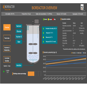
At SPSE, we regularly conduct product demonstrations and practical training for our products. The participation fee is free, so please feel free to join us. You will have the opportunity to use the software! ■ Introduction to gPROMS Process Model-based process engineering (batch and continuous processes) Catalyst reactor, adsorption separation, and membrane separation model library ■ Custom Modeling ■ Bioprocess Models ■ gPROMS Formulated Products Crystallization Analysis ■ gPROMS Formulated Products Oral Absorption Analysis *Please note that registration may take some time. We recommend applying early.

  • simulator
  • Analysis Services
  • Other analyses

Added to bookmarks

Bookmarks list

Bookmark has been removed

Bookmarks list

You can't add any more bookmarks

By registering as a member, you can increase the number of bookmarks you can save and organize them with labels.

Free membership registration

Software "G-POWER + Toughbook" <Rental>

Software that supports various tasks and management on water and land with enhanced functionality.

"G-POWER (GNSS Observation and Guidance Software) + Toughbook" is software that utilizes VRS, RTK, and DGPS to display and register the current location in real-time. Major Tech offers rental services for this product. Rentals are available starting from 7 days. It supports various tasks and management on water and land with comprehensive features, including coordinate measurement navigation. 【Features】 ■ Available for rent starting from 7 days ■ Utilizes VRS, RTK, and DGPS ■ Displays and registers the current location in real-time ■ Supports various tasks and management on water and land with comprehensive features, including coordinate measurement navigation *For more details, please refer to the PDF document or feel free to contact us.

  • Other measurement, recording and measuring instruments
  • Rental/lease
  • Software (middle, driver, security, etc.)

Added to bookmarks

Bookmarks list

Bookmark has been removed

Bookmarks list

You can't add any more bookmarks

By registering as a member, you can increase the number of bookmarks you can save and organize them with labels.

Free membership registration

gPROMS decarbonization solution

We support carbon neutrality with digital technologies for the process industry.

In order to build a decarbonized society, our company offers the following solutions: 1. CO2 Capture and Utilization One of the initiatives to reduce emissions is "CCUS." "CCUS" stands for "Carbon dioxide Capture, Utilization and Storage," which aims to utilize separated and stored CO2. 【gCCS】 A system modeling tool for the design and operational support of the CCS chain, developed in collaboration with E.ON (a German energy company supplying electricity and gas), EDF (a French electric utility company), Rolls-Royce Motor Cars (a British automobile manufacturer), and CO2DeepStore, funded by a project from the UK government agency (ETI). 2. Hydrogen Process Technology 3. gPROMS Utilities: Daily CO2 Emission Reduction Operational Support Optimization Tool

  • simulator
  • Analysis Services

Added to bookmarks

Bookmarks list

Bookmark has been removed

Bookmarks list

You can't add any more bookmarks

By registering as a member, you can increase the number of bookmarks you can save and organize them with labels.

Free membership registration

Simulation software 'gPROMS Process'

For process development, optimal plant design, and operational optimization studies! Simulators for the oil, gas, and chemical industries.

In plant design, equipment sizing, process consideration, and operational optimization, PSE believes that existing process simulators still have room for improvement in terms of convergence for obtaining numerical solutions, constraints of processes they can handle, and customization of process models (model extensibility). The process simulation software developed to meet the needs for more advanced and value-added process plant design and optimization is 'gPROMS Process'. 【Features】 * Libraries for specific applications * Creation of flow sheets using Drag & Drop * High-precision custom model creation and editing functions using gPROMS language * Changes in settings within the same environment from steady-state simulation models to dynamic simulation models * Powerful optimization solution search and analysis functions * Global System Analysis (GSA) * High-Performance Computing (HPC) ★ You can view two "case study materials" available for download. These include examples of achieving high-value product offerings and cost reduction through batch process optimization, as well as successful cases of cost reduction through the optimization of entire plants.

  • simulator

Added to bookmarks

Bookmarks list

Bookmark has been removed

Bookmarks list

You can't add any more bookmarks

By registering as a member, you can increase the number of bookmarks you can save and organize them with labels.

Free membership registration