Three-dimensional measurement using MMS can be utilized for the maintenance management of road facilities and road-related disaster prevention inspections!
Measurement using the Mobile Mapping System (MMS) allows for the efficient acquisition of all data related to road surface shapes, surrounding buildings, signs, guardrails, and details such as road markings and manholes, simply by driving a vehicle equipped with cameras, GPS, laser scanners, radar, and odometers (vehicle movement correction devices). The laser scanner can quickly and accurately measure a wide area of roads and their surroundings, enabling the collection of three-dimensional data, which is expected to be utilized in various fields. [MMS Mechanism] - Vehicle position and orientation are obtained using three GPS units, an IMU, and an odometer. - Synchronized laser scanners and cameras efficiently and accurately capture three-dimensional information of the road surface and surrounding areas while in motion. *For more details, please refer to the external link page or feel free to contact us.

Inquire About This Product
basic information
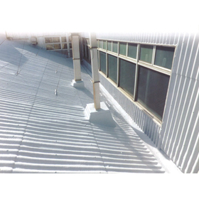
**Examples of MMS Usage** ■ Maintenance Management of Road Facilities and Accessories - It is possible to accurately grasp location information based on images of the surrounding environment and 3D point cloud data. ■ Slope Shape Measurement (Disaster Prevention Inspection) - By conducting regular measurements as part of disaster prevention maintenance for roads, data can be compared to understand changes over time. ■ Facility Design Support - Utilizing the acquired 3D point cloud data, it is possible to create longitudinal and cross-sectional diagrams at arbitrary points. - Data obtained by laser irradiation from below structures such as bridges can be overlaid and used for 3D design and information-based construction. *For more details, please refer to the external link page or feel free to contact us.*
Price range
Delivery Time
Applications/Examples of results
For more details, please refer to the external link page or feel free to contact us.
catalog(1)
Download All Catalogs
Company information

Mutsu Tech Consultant Co., Ltd. started as a surveying company, but now, thanks to our efforts, we have expanded our activities as a comprehensive construction consultant rooted in the community, covering surveying, design, land acquisition, compensation, and information systems. As a company that constantly focuses on advanced technology and actively continues to take on challenges, we aim to be a leading company in the field of 3D measurement. Moving forward, we will prioritize technology and trust in our business development and work towards contributing to society through our expertise, in order to meet our customers' expectations.