iPROS Manufacturing
  • Search for products by classification category

    • Electronic Components and Modules
      Electronic Components and Modules
      56317items
    • Machinery Parts
      Machinery Parts
      71353items
    • Manufacturing and processing machinery
      Manufacturing and processing machinery
      95896items
    • Scientific and Physics Equipment
      Scientific and Physics Equipment
      33359items
    • Materials
      Materials
      35073items
    • Measurement and Analysis
      Measurement and Analysis
      52849items
    • Image Processing
      Image Processing
      14754items
    • Control and Electrical Equipment
      Control and Electrical Equipment
      50439items
    • Tools, consumables, and supplies
      Tools, consumables, and supplies
      63067items
    • Design and production support
      Design and production support
      11846items
    • IT/Network
      IT/Network
      40923items
    • Office
      Office
      13327items
    • Business support services
      Business support services
      32162items
    • Seminars and Skill Development
      Seminars and Skill Development
      5745items
    • Pharmaceutical and food related
      Pharmaceutical and food related
      24835items
    • others
      60097items
  • Search for companies by industry

    • Manufacturing and processing contract
      7352
    • others
      5032
    • Industrial Machinery
      4426
    • Machine elements and parts
      3287
    • Other manufacturing
      2874
    • IT/Telecommunications
      2531
    • Trading company/Wholesale
      2459
    • Industrial Electrical Equipment
      2317
    • Building materials, supplies and fixtures
      1821
    • software
      1642
    • Electronic Components and Semiconductors
      1573
    • Resin/Plastic
      1489
    • Service Industry
      1422
    • Testing, Analysis and Measurement
      1131
    • Ferrous/Non-ferrous metals
      979
    • environment
      703
    • Chemical
      630
    • Automobiles and Transportation Equipment
      559
    • Printing Industry
      507
    • Information and Communications
      442
    • Consumer Electronics
      420
    • Energy
      320
    • Rubber products
      313
    • Food Machinery
      303
    • Optical Instruments
      281
    • robot
      270
    • fiber
      250
    • Paper and pulp
      231
    • Electricity, Gas and Water Industry
      171
    • Pharmaceuticals and Biotechnology
      166
    • Warehousing and transport related industries
      144
    • Glass and clay products
      142
    • Food and Beverage
      133
    • CAD/CAM
      122
    • retail
      111
    • Educational and Research Institutions
      108
    • Medical Devices
      101
    • Ceramics
      96
    • wood
      89
    • Transportation
      83
    • Medical and Welfare
      61
    • Petroleum and coal products
      60
    • Shipbuilding and heavy machinery
      52
    • Aviation & Aerospace
      48
    • Fisheries, Agriculture and Forestry
      40
    • Public interest/special/independent administrative agency
      27
    • self-employed
      23
    • equipment
      23
    • Government
      19
    • Research and development equipment and devices
      18
    • Materials
      18
    • Mining
      17
    • Finance, securities and insurance
      13
    • Individual
      10
    • Restaurants and accommodations
      8
    • cosmetics
      8
    • Police, Fire Department, Self-Defense Forces
      7
    • Laboratory Equipment and Consumables
      3
    • Contracted research
      3
    • Raw materials for reagents and chemicals
      2
  • Special Features
  • Ranking

    • Overall Products Ranking
    • Overall Company Ranking
Search for Products
  • Search for products by classification category

  • Electronic Components and Modules
  • Machinery Parts
  • Manufacturing and processing machinery
  • Scientific and Physics Equipment
  • Materials
  • Measurement and Analysis
  • Image Processing
  • Control and Electrical Equipment
  • Tools, consumables, and supplies
  • Design and production support
  • IT/Network
  • Office
  • Business support services
  • Seminars and Skill Development
  • Pharmaceutical and food related
  • others
Search for Companies
  • Search for companies by industry

  • Manufacturing and processing contract
  • others
  • Industrial Machinery
  • Machine elements and parts
  • Other manufacturing
  • IT/Telecommunications
  • Trading company/Wholesale
  • Industrial Electrical Equipment
  • Building materials, supplies and fixtures
  • software
  • Electronic Components and Semiconductors
  • Resin/Plastic
  • Service Industry
  • Testing, Analysis and Measurement
  • Ferrous/Non-ferrous metals
  • environment
  • Chemical
  • Automobiles and Transportation Equipment
  • Printing Industry
  • Information and Communications
  • Consumer Electronics
  • Energy
  • Rubber products
  • Food Machinery
  • Optical Instruments
  • robot
  • fiber
  • Paper and pulp
  • Electricity, Gas and Water Industry
  • Pharmaceuticals and Biotechnology
  • Warehousing and transport related industries
  • Glass and clay products
  • Food and Beverage
  • CAD/CAM
  • retail
  • Educational and Research Institutions
  • Medical Devices
  • Ceramics
  • wood
  • Transportation
  • Medical and Welfare
  • Petroleum and coal products
  • Shipbuilding and heavy machinery
  • Aviation & Aerospace
  • Fisheries, Agriculture and Forestry
  • Public interest/special/independent administrative agency
  • self-employed
  • equipment
  • Government
  • Research and development equipment and devices
  • Materials
  • Mining
  • Finance, securities and insurance
  • Individual
  • Restaurants and accommodations
  • cosmetics
  • Police, Fire Department, Self-Defense Forces
  • Laboratory Equipment and Consumables
  • Contracted research
  • Raw materials for reagents and chemicals
Special Features
Ranking
  • Overall Products Ranking
  • Overall Company Ranking
  • privacy policy
  • terms of service
  • About Us
  • Careers
  • Advertising
  1. Home
  2. Service Industry
  3. シーズプロジェクト
  4. Product/Service List
Service Industry
  • Added to bookmarks

    Bookmarks list

    Bookmark has been removed

    Bookmarks list

    You can't add any more bookmarks

    By registering as a member, you can increase the number of bookmarks you can save and organize them with labels.

    Free membership registration

シーズプロジェクト

addressShizuoka/Suruga-ku, Shizuoka-shi/Maruko 7313
phone080-6928-2585
  • Special site
  • Official site
last updated:Oct 27, 2025
シーズプロジェクトlogo
  • Contact this company

    Contact Us Online
  • Company information
  • Products/Services(23)
  • catalog(5)
  • news(0)

シーズプロジェクト List of Products and Services

  • category

1~15 item / All 15 items

Displayed results

Filter by category
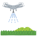
Digital twin technology Digital twin technology
活用イメージ 活用イメージ
活用イメージ

活用イメージ

弊社は自動3Dスキャナ『Hovermap』 を販売する代理店ではなく、 自社で運用して計測・解析・データ変換・BIM 化までを行う3D計測・データ提供の専門技術サービス会社 です。 現場で取得したスキャンデータをもとに、正確な点群情報や2D/3D モデルをお客様の目的に合わせて提供します。 つまり「機器を売る会社」ではなく、Hovermapの性能を最大限に活かし、現場の課題をデータで解決する会社です。

The benefits of visualizing factory spatial information and work procedures in 3D data.

/Explanation of Digital Twin/ Achieving a new work environment that "enhances human added value" through simulation × digital technology × AI!

A digital twin refers to the technology that reproduces real objects or systems on a computer, utilizing them for analysis, prediction, and improvement. By analyzing operational and production data within a factory, it becomes possible to identify bottlenecks and enhance work efficiency, leading to increased productivity and cost reduction. ■ Benefits of Implementing Digital Twins 1. Remote understanding of on-site conditions You can check the operational status of machines and the condition of production lines in real-time from remote locations, making discussions more efficient. 2. Safe information management Digital twins display only essential information and can mask confidential parts, thereby enhancing safety. 3. Flexible and intuitive information display Unlike flat dashboards, you can freely change perspectives and overlay information, allowing for an intuitive grasp of on-site conditions. 4. Contributing to securing young talent It becomes easier to dispel the image of "3K (hard, dirty, dangerous)" and promote the workplace as a comfortable and advanced environment. \ For more details, please view the PDF data by downloading the catalog / We also welcome inquiries regarding digital twins and data measurement, so feel free to contact us.

Added to bookmarks

Bookmarks list

Bookmark has been removed

Bookmarks list

You can't add any more bookmarks

By registering as a member, you can increase the number of bookmarks you can save and organize them with labels.

Free membership registration

Manufacturing × Drones: For recording the current status of factory facilities and design support during equipment updates.

High-precision scanning in places where GPS is unavailable, such as indoors, underground, and behind structures, which were difficult to scan conventionally!

Hovermap is an unmanned aerial vehicle that can be used for recording the current state of factory facilities, design support during equipment updates, and maintenance management. By non-contact scanning of high places and hazardous areas with a drone, it is possible to ensure both worker safety and surveying efficiency. It enables "immediate scanning and immediate aerial photography" for initial response at disaster and accident sites, excelling in insurance and investigation capabilities. 【Features】 - High-precision scanning of locations that are difficult to scan with conventional methods, such as indoors, underground, and behind structures where GPS signals do not reach. - Generation of high-precision and high-quality 3D models through the combination of photogrammetry. - A composite technology of aerial photography and scanning that allows for a three-dimensional understanding of structures and digital archiving. *For more details, please download the PDF or contact us.

Added to bookmarks

Bookmarks list

Bookmark has been removed

Bookmarks list

You can't add any more bookmarks

By registering as a member, you can increase the number of bookmarks you can save and organize them with labels.

Free membership registration

[Architecture and Civil Engineering × Drones] For recording structural scans and before-and-after seismic reinforcement design.

High-precision and high-quality 3D model generation is possible by combining with photogrammetry!

"Hovermap" is an unmanned aerial vehicle that can be used for structural scanning, recording before and after seismic reinforcement design, and supporting the introduction of BIM. It is capable of scanning high places, undersides, indoors, and underground, making it applicable to a wide range of industries and sites. Additionally, it supports the creation of evidence materials that can be submitted to government agencies, insurance companies, etc., for deterioration diagnosis and pre- and post-construction records. 【Features】 ■ High-precision scanning of areas that were difficult to scan with conventional methods, such as indoors, underground, and the undersides of structures where GPS signals are unavailable. ■ Generation of high-precision and high-quality 3D models through the combined use of photogrammetry. ■ Three-dimensional structural understanding and digital archiving through a combination of aerial photography and scanning technology. *For more details, please download the PDF or contact us.

Added to bookmarks

Bookmarks list

Bookmark has been removed

Bookmarks list

You can't add any more bookmarks

By registering as a member, you can increase the number of bookmarks you can save and organize them with labels.

Free membership registration

【Media and Video Production × Drone】Aerial Photography and Structure CG Generation

Scanning of high places, back surfaces, indoors, and underground is also possible, making it applicable to a wide range of industries and sites!

"Hovermap" is an unmanned aerial vehicle that can be used for capturing background materials for virtual production, aerial photography, and generating CG of structures. Our company possesses the technical capability to operate drone aerial photography, Hovermap scanning, and photogrammetry as an integrated service. Additionally, our track record of providing aerial photography for NHK information programs and historical dramas has established a high level of trust with media and government agencies. 【Features】 ■ High-precision scanning of locations that are difficult to scan with conventional methods, such as indoors, underground, and behind structures where GPS signals are unavailable. ■ Generation of high-precision and high-quality 3D models through the combined use of photogrammetry. ■ Three-dimensional structural understanding and digital archiving through the combined technology of aerial photography and scanning. *For more details, please download the PDF or contact us.

Added to bookmarks

Bookmarks list

Bookmark has been removed

Bookmarks list

You can't add any more bookmarks

By registering as a member, you can increase the number of bookmarks you can save and organize them with labels.

Free membership registration

[Disaster Investigation and Insurance Assessment Company × Drone] Aerial Photography of Damage Sites from Typhoons, Earthquakes, etc.

Support for the creation of evidence documents that can be submitted to government agencies, insurance companies, etc., such as deterioration diagnosis and records before and after construction!

"Hovermap" is an unmanned aerial vehicle that can be used for aerial photography and 3D recording of disaster sites such as typhoons, earthquakes, and fires, as well as for creating damage reports with evidence images. It enables "immediate scanning and immediate aerial photography" for initial response at disaster and accident sites, demonstrating excellent capabilities for insurance and investigation. Additionally, its track record of providing aerial photography for NHK information programs and historical dramas enhances its reliability with media and government agencies. 【Features】 ■ High-precision scanning of locations that are difficult to scan with conventional methods, such as indoors, underground, and behind structures where GPS signals are unavailable. ■ Generation of high-precision and high-quality 3D models through the combination of photogrammetry. ■ A composite technology of aerial photography and scanning that allows for a three-dimensional understanding of structures and digital archiving. *For more details, please download the PDF or contact us.

Added to bookmarks

Bookmarks list

Bookmark has been removed

Bookmarks list

You can't add any more bookmarks

By registering as a member, you can increase the number of bookmarks you can save and organize them with labels.

Free membership registration

Building Management and FM × Drones: Visualization of Current Conditions in Tenant Buildings and Hospitals

Scanning of high places, back sides, indoors, and underground is also possible, making it applicable to a wide range of industries and sites!

Hovermap is an unmanned aerial vehicle that can be used for visualizing the current state of tenant buildings, hospitals, schools, and public facilities, supporting planning during equipment updates, and creating 3D representations of facility assets. It assists in creating evidence materials that can be submitted to government agencies, insurance companies, etc., such as deterioration diagnosis and pre- and post-construction records. Additionally, 3D data can be utilized throughout the entire lifecycle of the facility, contributing to long-term maintenance and asset management. 【Features】 - High-precision scanning of areas that are difficult to scan with conventional methods, such as indoors, underground, and behind structures where GPS signals are unavailable. - Generation of high-precision and high-quality 3D models through the combined use of photogrammetry. - Three-dimensional structural understanding and digital archiving through a combination of aerial photography and scanning technologies. *For more details, please download the PDF or contact us.

Added to bookmarks

Bookmarks list

Bookmark has been removed

Bookmarks list

You can't add any more bookmarks

By registering as a member, you can increase the number of bookmarks you can save and organize them with labels.

Free membership registration

[Robotics Trading Company × Drone] Facility Survey Before Introducing AGV/AMR

Support for the creation of evidence documents that can be submitted to government agencies, insurance companies, etc., such as deterioration diagnosis and records before and after construction!

"Hovermap" is an unmanned aerial vehicle capable of facility surveys, flow design, and obstacle mapping before the introduction of AGVs and AMRs. It can also scan high places, undersides, indoors, and underground, making it applicable across a wide range of industries and sites. Additionally, by non-contact scanning of high or hazardous areas with a drone, it is possible to ensure both the safety of workers and the efficiency of surveying. 【Features】 ■ High-precision scanning of locations that are difficult to scan with traditional methods, such as indoors, underground, and behind structures where GPS signals do not reach. ■ Generation of high-precision and high-quality 3D models through the combination of photogrammetry. ■ Three-dimensional structural understanding and digital archiving through a combination of aerial photography and scanning technologies. *For more details, please download the PDF or contact us.

Added to bookmarks

Bookmarks list

Bookmark has been removed

Bookmarks list

You can't add any more bookmarks

By registering as a member, you can increase the number of bookmarks you can save and organize them with labels.

Free membership registration

Private Owners × Drones: Current Condition Acquisition of Warehouses, Stores, and Aging Facilities

Photorealistic 3D visualization using tools like Twinmotion enables support for consensus building among stakeholders, residents, and government!

"Hovermap" is an unmanned aerial vehicle capable of acquiring the current state of warehouses, stores, and aging facilities, as well as creating 3D drawings and facilitating administrative applications. It supports the creation of evidence materials that can be submitted to authorities and insurance companies, such as deterioration diagnosis and pre- and post-construction records. Additionally, 3D data can be utilized throughout the entire lifecycle of the facility, contributing to long-term maintenance and asset management. 【Features】 ■ High-precision scanning of locations that were difficult to scan with conventional methods, such as indoors, underground, and behind structures where GPS signals do not reach. ■ Generation of high-precision and high-quality 3D models through the combination of photogrammetry. ■ Three-dimensional structural understanding and digital archiving through a combination of aerial photography and scanning technologies. *For more details, please download the PDF or contact us.

Added to bookmarks

Bookmarks list

Bookmark has been removed

Bookmarks list

You can't add any more bookmarks

By registering as a member, you can increase the number of bookmarks you can save and organize them with labels.

Free membership registration

[Urban Planning Operators × 3D Data Utilization] Acquisition of Current 3D Data for Redevelopment Areas, etc.

We possess the technical capability to operate drone aerial photography, Hovermap scanning, and photogrammetry as an integrated system, demonstrating high adaptability!

Using the unmanned aerial vehicle 'Hovermap', it is possible to obtain 3D data of the current state of redevelopment areas, conduct spatial simulations, and create visualization content for residents and government officials. With photorealistic 3D visualization using tools like Twinmotion, we can support consensus-building among stakeholders, residents, and government officials. Additionally, our track record of providing aerial footage for NHK information programs and historical dramas enhances our credibility with media and government agencies. 【Features】 - High-precision scanning of locations where GPS signals are unavailable, such as indoors, underground, and behind structures, which were difficult to scan conventionally. - Generation of high-precision and high-quality 3D models through the combination of photogrammetry. - A composite technology of aerial photography and scanning for a three-dimensional understanding of structures and digital archiving. *For more details, please download the PDF or contact us.

Added to bookmarks

Bookmarks list

Bookmark has been removed

Bookmarks list

You can't add any more bookmarks

By registering as a member, you can increase the number of bookmarks you can save and organize them with labels.

Free membership registration

Infrastructure × Drones: For the diagnosis of aging bridges, tunnels, and water supply and sewage systems.

Three-dimensional structural understanding and digital archiving using a combination of aerial photography and scanning technology!

"Hovermap" is an unmanned aerial vehicle capable of diagnosing the deterioration of bridges, tunnels, and water supply and drainage systems, as well as improving the efficiency of regular inspections. It supports the creation of evidence materials that can be submitted to government agencies and insurance companies, such as deterioration diagnosis and pre- and post-construction records. Additionally, due to its track record of providing aerial footage for NHK information programs and historical dramas, it has high reliability with media and government agencies. 【Features】 ■ High-precision scanning of areas that are difficult to scan with conventional methods, such as indoors, underground, and the backs of structures, where GPS signals do not reach. ■ Generation of high-precision and high-quality 3D models through the combined use of photogrammetry. ■ Three-dimensional structural understanding and digital archiving through a combination of aerial photography and scanning technology. *For more details, please download the PDF or contact us.

Added to bookmarks

Bookmarks list

Bookmark has been removed

Bookmarks list

You can't add any more bookmarks

By registering as a member, you can increase the number of bookmarks you can save and organize them with labels.

Free membership registration

[Large Structures/Shipbuilding × Utilization of 3D Data] Measurement, Design, and Maintenance Support for Shipyards

3D data can be utilized throughout the entire lifecycle of the facility, contributing to long-term maintenance and asset management!

Using the unmanned aerial vehicle 'Hovermap', it is possible to conduct 3D measurements, design, and maintenance support for large-scale, high-altitude, and complex structures such as shipyards, port facilities, tanks, and transmission towers. Scanning in high places, on the underside, indoors, and underground is also possible, making it applicable to a wide range of industries and sites. Additionally, by performing non-contact scans of high places and hazardous areas with drones, it is possible to ensure both the safety of workers and the efficiency of surveying. 【Features】 ■ High-precision scanning of locations where conventional scanning has been difficult, such as indoors, underground, and the undersides of structures where GPS signals do not reach. ■ Generation of high-precision and high-quality 3D models through the combined use of photogrammetry. ■ Three-dimensional structural understanding and digital archiving through a combination of aerial photography and scanning technologies. *For more details, please download the PDF or contact us.

Added to bookmarks

Bookmarks list

Bookmark has been removed

Bookmarks list

You can't add any more bookmarks

By registering as a member, you can increase the number of bookmarks you can save and organize them with labels.

Free membership registration

[Plant Engineering Company × Drone] Scanning of Complex Piping Structures

Scanning of high places, back surfaces, indoors, and underground is also possible, making it applicable to a wide range of industries and sites!

"Hovermap" is an unmanned aerial vehicle that can be used for scanning and BIM modeling of complex piping structures in chemical, food, and pharmaceutical plants, as well as for maintenance planning and safety design purposes. 3D data can be utilized throughout the entire lifecycle of the facility, contributing to long-term maintenance and asset management. Additionally, it supports the creation of evidence materials that can be submitted to authorities and insurance companies, such as deterioration diagnosis and pre- and post-construction records. 【Features】 ■ High-precision scanning of locations that are difficult to scan with conventional methods, such as indoors, underground, and behind structures where GPS signals are unavailable. ■ Generation of high-precision and high-quality 3D models through the combination of photogrammetry. ■ Three-dimensional structural understanding and digital archiving through a combination of aerial photography and scanning technology. *For more details, please download the PDF or contact us.

Added to bookmarks

Bookmarks list

Bookmark has been removed

Bookmarks list

You can't add any more bookmarks

By registering as a member, you can increase the number of bookmarks you can save and organize them with labels.

Free membership registration

Electricity, gas, and communication infrastructure companies × drones: 3D recording of power plants, etc.

By non-contact scanning high places and dangerous areas with drones, it is possible to ensure both the safety of workers and the efficiency of surveying!

"Hovermap" is an unmanned aerial vehicle that can be used for 3D recording of power plants, substations, relay stations, and pipelines, as well as for disaster response and regular inspections and analysis of aging infrastructure. 3D data can be utilized throughout the entire lifecycle of facilities, contributing to long-term maintenance and asset management. Additionally, it is capable of scanning high places, back sides, indoors, and underground, making it applicable across a wide range of industries and sites. [Features] - High-precision scanning of locations that were difficult to scan with conventional methods, such as indoors, underground, and behind structures where GPS signals are unavailable. - Generation of high-precision and high-quality 3D models through the combination of photogrammetry. - Three-dimensional structural understanding and digital archiving through a combination of aerial photography and scanning technologies. *For more details, please download the PDF or contact us.

Added to bookmarks

Bookmarks list

Bookmark has been removed

Bookmarks list

You can't add any more bookmarks

By registering as a member, you can increase the number of bookmarks you can save and organize them with labels.

Free membership registration

"Resource development, mining, geological survey company × drone" Scanning of mining sites, etc.

By non-contact scanning of high places and dangerous areas with drones, it is possible to ensure both the safety of workers and the efficiency of surveying!

"Hovermap" is an unmanned aerial vehicle that can be used for scanning mining sites and tunnels, understanding faults and calculating volumes, and managing shapes through photogrammetry. It enables "immediate scanning and immediate aerial photography" for initial response during disasters and accidents, excelling in insurance and investigation capabilities. Additionally, it supports the creation of evidence materials that can be submitted to government agencies and insurance companies, such as deterioration diagnosis and pre- and post-construction records. 【Features】 ■ High-precision scanning of areas that are difficult to scan with conventional methods, such as indoors, underground, and behind structures where GPS signals are unavailable. ■ Generation of high-precision and high-quality 3D models through the combination of photogrammetry. ■ Three-dimensional structural understanding and digital archiving through a combination of aerial photography and scanning technologies. *For more details, please download the PDF or contact us.

Added to bookmarks

Bookmarks list

Bookmark has been removed

Bookmarks list

You can't add any more bookmarks

By registering as a member, you can increase the number of bookmarks you can save and organize them with labels.

Free membership registration

Report on Laser Scan Results and Use Cases with Hovermap STX

An efficient data acquisition method utilizing advanced technology! Also introducing future directions.

This document includes a report on the results of laser scanning within the factory using Hovermap STX and examples of its application. We introduce the "technical features and reasons for the introduction of Hovermap STX," highlighting the use of SLAM technology, high-precision 3D mapping, shortened construction periods, and improved safety. Additionally, at the end of the document, we also cover the effects of introducing Hovermap STX, as well as the benefits of management and renovation. Please take a look. [Contents] ■ Overview of Hovermap STX and its application in factory scanning ■ Introduction of laser scanning results within the factory ■ Utilization of scan data and future prospects ■ Summary and future direction *For more details, please download the PDF or feel free to contact us.

Added to bookmarks

Bookmarks list

Bookmark has been removed

Bookmarks list

You can't add any more bookmarks

By registering as a member, you can increase the number of bookmarks you can save and organize them with labels.

Free membership registration
Prev 1 Next
  • ウェブハンドリングの課題を解決!非接触の塵埃除去装置などを紹介

    ウェブハンドリングの課題を解決!非接触の塵埃除去装置などを紹介

  • N先生がマル秘技術を解説! KS保守セット KVアダプター 資料請求をして先着30名様にプリペイドカード1000円分プレゼント! 是非“チャンネル登録”をお願いします! ※プレゼント詳細はチャンネル概要欄をご確認下さい。
  • 12/14までに無料掲載を申し込むだけ 抽選で20名様にAmazonギフトカード5,000円分プレゼント!
    • Contact this company

      Contact Us Online

    Products

    • Search for Products

    Company

    • Search for Companies

    Special Features

    • Special Features

    Ranking

    • Overall Products Ranking
    • Overall Company Ranking

    support

    • site map
    IPROS
    • privacy policy Regarding external transmission of information
    • terms of service
    • About Us
    • Careers
    • Advertising
    COPYRIGHT © 2001-2025 IPROS CORPORATION ALL RIGHTS RESERVED.
    Please note that the English text on this page is automatically translated and may contain inaccuracies.