From agriculture, forestry, fisheries, and environmental protection to construction, civil engineering, and high-precision mapping.
The world revealed by satellites and drones: The free provision of commercial satellite data from public agencies (NASA, ESA) is progressing, and numerous businesses utilizing this data are about to emerge. While there are many books summarizing the basics of remote sensing and data analysis techniques, there has not been a technical book that compiles application examples from various fields into one volume. This book is ideal not only for researchers and developers involved in various fields of remote sensing but also for those considering the creation of new businesses. By analyzing and interpreting data captured from satellites and drones, it explains various use cases of satellite imagery, such as predicting crop yields and managing growth, monitoring infrastructure like roads and railways, preventing illegal logging in the Amazon region, and understanding changes in the marine environment.
Inquire About This Product
basic information
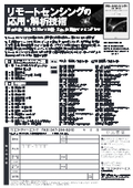
"Applications and Analytical Techniques of Remote Sensing - From Agriculture, Forestry, Fisheries, and Environment to Disaster Prevention, Architecture, Civil Engineering, and High-Precision Mapping" Publication Date: August 2019 Price: 58,000 yen + tax Format: B5 size, 506 pages Publisher: NTS Corporation ISBN: 978-4-86043-612-4 C3055 ■ Supervisors Hironori Nakayama, Specially Appointed Professor, College of Humanities and Sciences, Nihon University Toshiro Sugimura, Professor, College of Industrial Technology, Nihon University ■ Authors: 58 in total ■ Table of Contents Introduction (Preface) Part 1: Fundamentals of Remote Sensing Chapter 1: Observation Processing and Acquisition of Remote Sensing Data Chapter 2: Image Analysis Chapter 3: Correction Processing of Satellite Data Chapter 4: Information Extraction Part 2: Application Cases Chapter 1: Agricultural Sector Chapter 2: Fisheries Sector Chapter 3: Forestry Sector Chapter 4: Economic Activity Sector Chapter 5: Environmental Sector Chapter 6: Marine Sector Chapter 7: Disaster Prevention and Disaster Sector Chapter 8: Architecture and Civil Engineering Sector Chapter 9: High-Precision Mapping Chapter 10: Other Sectors Chapter 11: Legal Issues for the Development of Satellite Remote Sensing Projects
Price information
List Price: 58,000 yen + tax
Price range
P2
Delivery Time
P2
Applications/Examples of results
Forecasting agricultural crop yields Early prediction of grain yields Management of agricultural crop growth High-resolution satellite constellation Drone systems Measurement of crop and field information and its application in smart agriculture Cloud-based agricultural support services Tea plantation management Monitoring surface temperature of rice paddy communities Winter diatom red tide prediction Support system for forest management planning Understanding the damage situation of oak wilt and control measures Classification of pine wilt damage Forest fires Analysis of light energy distribution in metropolitan areas Weather index insurance Measurement of air pollution gases Water quality analysis in Tokyo Bay Drought indicators Analysis of thermal environments in urban areas Reduction of illegal logging Long-term variations in glacier flow velocity Observation of glaciers and ice sheets Sea ice observation Vessel monitoring technology Remote sensing of coral reefs Disaster monitoring Detection of landslide areas Volcano observation Crustal deformation observation Assessment of building damage Backscatter characteristics of bridges Disaster waste generation Monitoring of underground construction fluctuations Estimation of building floor area Aerial LiDAR Thermal environment mitigation effects of trees in urban spaces High-resolution global terrain data Centimeter-level positioning augmentation service using quasi-zenith satellites Measurement of velocity vectors of moving objects using satellite stereo images Geological and mineral mapping methods Wildlife detection Polarimetric SAR data
catalog(8)
Download All Catalogs

Company information
NTS selects reliable information from the overwhelming amount of information through seminars, publications, and literature information activities, and passes it on to the next generation. From abundance to certainty—that is the philosophy of NTS's activities.


![[Information] IoT Platform 'Iroato' Use Cases, New Topics](https://image.mono.ipros.com/public/product/image/ae5/2000533077/IPROS52325803470325016541.png?w=280&h=280)

