46~61 item / All 61 items
Displayed results

Added to bookmarks
Bookmarks listBookmark has been removed
Bookmarks listYou can't add any more bookmarks
By registering as a member, you can increase the number of bookmarks you can save and organize them with labels.
Free membership registration
Contact this company
Inquiry Form46~61 item / All 61 items
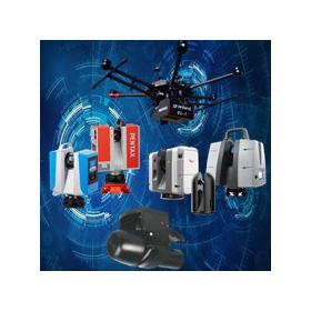
We would like to introduce the "3D surveying equipment" that we handle. Starting with Leica's lightweight and easy-to-operate "RTC360" and long-range "P50," we also offer the PENTAX UAV laser scanner "UL-1," the mid-range "Z+F IMAGER5016," and "S-3180V." Additionally, we have the underwater multi-sonar "iWBMS" series from NORBIT, which enables the acquisition of 3D data underwater. Furthermore, we have a wide range of products available, including the imaging laser scanner "BLK360." 【Product Lineup】 ■Leica ・RTC360 ・P50 and other P series ・BLK360 ■PENTAX ・UAV laser scanner UL-1 ・Z+F IMAGER5016 ・S-3180V and other S series ■NORBIT ・Underwater multi-sonar iWBMS series *For more details, please refer to the PDF document or feel free to contact us.
Added to bookmarks
Bookmarks listBookmark has been removed
Bookmarks listYou can't add any more bookmarks
By registering as a member, you can increase the number of bookmarks you can save and organize them with labels.
Free membership registration
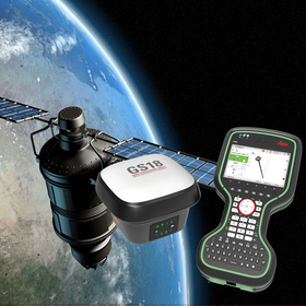
The "Leica GS18I" is a high-precision GNSS surveying instrument with excellent operability. Designed to efficiently position a large number of points, this product allows you to measure hundreds of points within minutes after capturing images. Since there is no need to physically move to the points being measured, it reduces the time spent on-site and the time required for redoing measurement tasks. Additionally, by creating point cloud data from the data acquired on Infinity, new proposals become possible. 【Features】 ■ Adopts innovative visual positioning technology developed by seamlessly integrating GNSS, IMU, and cameras ■ Capable of positioning points from images both in the field and in the office ■ Designed to efficiently position a large number of points ■ Capable of measuring hundreds of points within minutes after capture *For more details, please refer to the catalog or PDF materials, or feel free to contact us. ★ This product is a surveying instrument that can utilize "subsidy support" upon purchase. It may be possible to purchase at a price of 1/2 to 1/3 of the regular price! If you are interested, please do not hesitate to contact us.
Added to bookmarks
Bookmarks listBookmark has been removed
Bookmarks listYou can't add any more bookmarks
By registering as a member, you can increase the number of bookmarks you can save and organize them with labels.
Free membership registration
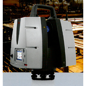
The "Leica ScanStation P30/40" is an ideal laser scanner in terms of measurement time, measurement range, accuracy, and durability, ensuring the capture of details. It has a maximum measurement distance of 270 meters and generates high-quality 3D data and HDR images at a speed of 1 million points per second. It produces high-quality, realistic 3D color point cloud data with excellent measurement range and angular accuracy, low range noise, and a two-axis correction suitable for surveying. 【Features】 ■ Ensures accurate measurement of details ■ The right choice ■ High performance even in harsh environments ■ Reduced downtime ■ Total scanning system *For more details, please refer to the PDF document or feel free to contact us.
Added to bookmarks
Bookmarks listBookmark has been removed
Bookmarks listYou can't add any more bookmarks
By registering as a member, you can increase the number of bookmarks you can save and organize them with labels.
Free membership registration
The "Monozukuri, Commerce, and Service Subsidy" is a subsidy program that supports capital investment for the development of new products and services, as well as improvements in production processes. Any small or medium-sized enterprise that formulates and implements a business plan (3 to 5 years) that meets the requirements can apply. We encourage you to consider this opportunity. 【Features】 ■ Supports capital investment for improvements in production processes, etc. ■ Available to anyone aiming to enhance productivity ■ Unprecedented "ease of use" ■ Various business ideas are being realized one after another ■ New menus to accommodate various initiatives *For more details, please refer to the PDF materials or feel free to contact us.
Added to bookmarks
Bookmarks listBookmark has been removed
Bookmarks listYou can't add any more bookmarks
By registering as a member, you can increase the number of bookmarks you can save and organize them with labels.
Free membership registration
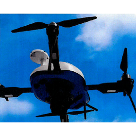
Yokohama Instruments handles AeroSense's "AEROBO." Specialized for surveying and inspection applications, it is equipped with a high-resolution camera. It achieves automatic takeoff and landing, as well as autonomous flight, based on a unique flight plan, and can be expanded in various ways according to applications, including infrared sensors and spectral cameras. Additionally, we offer GNSS surveying equipment such as "AEROBO MARKER" and "AEROBO CLOUD." 【Features of AEROBO】 ■ Japanese-made drone enabling high-precision measurement and analysis ■ Specialized for surveying and inspection applications ■ Equipped with a high-resolution camera ■ Capable of various expansions according to applications *For more details, please refer to the PDF document or feel free to contact us.
Added to bookmarks
Bookmarks listBookmark has been removed
Bookmarks listYou can't add any more bookmarks
By registering as a member, you can increase the number of bookmarks you can save and organize them with labels.
Free membership registration
The IT Implementation Subsidy is a subsidy program adopted by the Ministry of Economy, Trade and Industry aimed at small and medium-sized enterprises and small businesses. It seeks to improve sales and productivity through the IT transformation of operations and to realize work style reforms. By selecting IT tools that have been pre-registered by IT implementation supporters or consortia and applying for the grant, you can receive a subsidy of up to half of the costs incurred from the introduction of IT tools. 【Do you have any of these concerns?】 ■ I don't have time and I don't know how to apply ■ I'm worried if it can really be done ■ I'm concerned about ongoing operations ■ If I apply, will I definitely be accepted? *For more details, please refer to the external link page or feel free to contact us.
Added to bookmarks
Bookmarks listBookmark has been removed
Bookmarks listYou can't add any more bookmarks
By registering as a member, you can increase the number of bookmarks you can save and organize them with labels.
Free membership registration
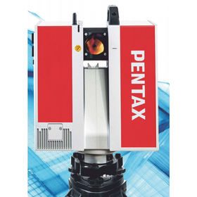
The "PENTAX S Series" is a 3D and 2D laser scanner that supports high-speed scanning at one million points per second. It includes the 3D laser scanner "S-3180," which captures clear point cloud data with extremely low noise in a short time, and the 2D laser scanner "S-2100." 【Product Lineup】 ■ 3D Laser Scanner "S-3180V" ■ 3D Laser Scanner "S-3180" ■ 2D Laser Scanner "S-2100" *For more details, please refer to the PDF document or feel free to contact us. ★ This product is a surveying instrument eligible for "subsidy utilization" upon purchase. It may be available at a price of 1/2 to 1/3 of the regular price! If you are interested, please do not hesitate to contact us.
Added to bookmarks
Bookmarks listBookmark has been removed
Bookmarks listYou can't add any more bookmarks
By registering as a member, you can increase the number of bookmarks you can save and organize them with labels.
Free membership registration
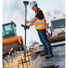
The "GS18 T" is a highly operable GNSS RTK rover. It allows for quick measurements at any point without the need to set the antenna pole vertically. Additionally, this product differs from others on the market in that it corrects pole tilt without using a magnetometer for each measurement. No adjustment for tilt correction is necessary, and it is not affected by metal interference. 【Features】 ■ High operability ■ Equipped with advanced tilt correction technology ■ Eliminates electromagnetic interference ■ No calibration required ■ Ready to use as soon as it is taken out of the case *For more details, please refer to the PDF document or feel free to contact us. ★ This product is a surveying instrument eligible for "subsidy utilization" upon purchase. It may be available for purchase at 1/2 to 1/3 of the regular price! If you are interested, please do not hesitate to contact us.
Added to bookmarks
Bookmarks listBookmark has been removed
Bookmarks listYou can't add any more bookmarks
By registering as a member, you can increase the number of bookmarks you can save and organize them with labels.
Free membership registration
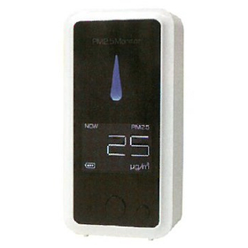
The "Air-monitor" measures the concentration of airborne particles (PM2.5). With a beautifully designed and easy-to-read display, the concentration level is clearly shown with LED indicators. It is easy to operate with just two buttons and is conveniently portable due to its palm-sized design. Use this product to measure PM2.5 concentrations and prevent health impacts in advance. 【Features】 ■ LED display clearly shows concentration levels ■ Measurement error ±15% ■ Beautiful and easy-to-read display ■ Simple operation with two buttons ■ Conveniently portable, palm-sized design *For more details, please refer to the PDF document or feel free to contact us. *This PDF is a digest version. If you would like the complete version, please contact us.
Added to bookmarks
Bookmarks listBookmark has been removed
Bookmarks listYou can't add any more bookmarks
By registering as a member, you can increase the number of bookmarks you can save and organize them with labels.
Free membership registration
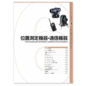
The "Position Measurement and Communication Equipment Catalog" is a catalog featuring products handled by Yokohama Soki, which engages in the sale, repair, and rental of surveying equipment. We introduce a wide range of products, including the "laser marker" that can be selected based on preferences and conditions, variations of "specific low-power transceivers" suited for different functions and applications, and "digital simple radios" suitable for long-distance use. [Contents (excerpt)] ■ Laser marker / Options ■ Automatic level (Auto level) ■ Rotating laser ■ Level pointer ■ Digital theodolite ■ Total station *For more details, please refer to the PDF document or feel free to contact us.
Added to bookmarks
Bookmarks listBookmark has been removed
Bookmarks listYou can't add any more bookmarks
By registering as a member, you can increase the number of bookmarks you can save and organize them with labels.
Free membership registration
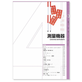
The "Surveying Equipment Catalog" is a catalog featuring products handled by Yokohama Soki, which engages in the sale, repair, and rental of surveying equipment. We introduce a rich lineup including the lightweight and sturdy telescopic aluminum pole "My Pole," as well as "Leveling Instruments" that can be used for vertical alignment of poles, staffs, and rods, and the lightweight and durable plastic marking stake "Sankui." [Contents (excerpt)] ■ Poles ■ Pin poles / Pole stands / Pin pole stands ■ Leveling instruments ■ Surveying nails / Boundary marking boards ■ Bases ■ Number plates *For more details, please refer to the PDF materials or feel free to contact us.
Added to bookmarks
Bookmarks listBookmark has been removed
Bookmarks listYou can't add any more bookmarks
By registering as a member, you can increase the number of bookmarks you can save and organize them with labels.
Free membership registration
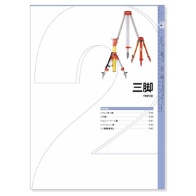
This catalog features aluminum tripods, wooden legs, elevator tripods, and prism tripods. We introduce a wide range of products, including the world-standard tripod "Landleg," which fully complies with international ISO standards, the "Precision Wooden Legs Dual Lock Type" that allows for the safe and secure installation of heavy machinery, and various "Prism Tripods" designed with usability as a top priority. [Contents] ■ Aluminum Tripods ■ Wooden Legs ■ Elevator Tripods ■ Prism Tripods ■ Tripod Accessories *For more details, please refer to the PDF document or feel free to contact us.
Added to bookmarks
Bookmarks listBookmark has been removed
Bookmarks listYou can't add any more bookmarks
By registering as a member, you can increase the number of bookmarks you can save and organize them with labels.
Free membership registration
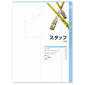
The "Staff Catalog" features aluminum staffs that support work on-site with high durability. We introduce a rich lineup, starting with the high-quality "My Staff" for leveling, measuring height differences, and general surveying applications, as well as the standard type "Sun Argo Yellow" and the wide type "Argo ST." Since the usage varies by site, we have prepared a diverse range of products, allowing you to choose the most suitable one based on size, product name, model/type, and purpose. [Contents] ■ Aluminum Staffs ■ Aluminum Staffs / High-Quality Type ■ Aluminum Staffs / Standard Type ■ Aluminum Staffs / Wide Type *For more details, please refer to the PDF document or feel free to contact us.
Added to bookmarks
Bookmarks listBookmark has been removed
Bookmarks listYou can't add any more bookmarks
By registering as a member, you can increase the number of bookmarks you can save and organize them with labels.
Free membership registration
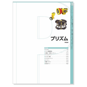
The "Prism Catalog" features automatic tracking prisms such as the "ZERO220," which enables surveying using an automatic tracking total station, as well as distance measuring and angle measuring prisms like the "M-1500 Prism" and "M-1000MP Prism." Additionally, it introduces prism tripods used for fixing DM pin poles, various adapters, and GNSS-related products. 【Contents】 ■ Prisms ■ Prism-related accessories ■ Levels / DM pin poles ■ Prism poles ■ Prism tripods, etc. *For more details, please refer to the PDF document or feel free to contact us.
Added to bookmarks
Bookmarks listBookmark has been removed
Bookmarks listYou can't add any more bookmarks
By registering as a member, you can increase the number of bookmarks you can save and organize them with labels.
Free membership registration
"WingNeo INFINITY" incorporates innovations that allow it to handle both office work and fieldwork with a single device. When taken out to the field as a mobile solution, it enables tasks that were desired on-site, such as wave observation, traverse calculations, and diagramming. Tasks that were previously performed using standalone applications like electronic field notebooks and electronic tablets can now be accomplished simply by carrying the INFINITY license. [Features] ■ Addition of CAD text and text augmentation ■ Main screen switching ■ Utilization of Exif information from commercially available cameras ■ CAD surface transparency settings ■ Strengthened relationship between pages and editing tasks *For more details, please refer to the PDF materials or feel free to contact us.
Added to bookmarks
Bookmarks listBookmark has been removed
Bookmarks listYou can't add any more bookmarks
By registering as a member, you can increase the number of bookmarks you can save and organize them with labels.
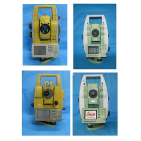
Free membership registrationOur company offers rental and sales of surveying equipment, GPS, copiers, and air purifiers, and we handle a variety of used surveying equipment. We have a wide selection available, including the TOPCON "QS5AC" with automatic leveling function, the standard model "Leica TCRA1205Lite," and the high-performance model "Leica TCRP1205+R1000." *For more details, please download the PDF or feel free to contact us.
Added to bookmarks
Bookmarks listBookmark has been removed
Bookmarks listYou can't add any more bookmarks
By registering as a member, you can increase the number of bookmarks you can save and organize them with labels.
Free membership registration