Causes and Solutions for the Misalignment of 'Surfer' Data — Correct Settings for the Coordinate System
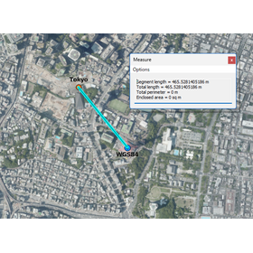
Introduction When creating maps with Surfer, you may encounter issues such as "the loaded data is displayed in a completely different location on the map" or "the position shifts when multiple layers are overlaid." Many of these problems stem from mistakes in the coordinate system settings. In this article, we will explain why these discrepancies occur and provide step-by-step instructions on how to set it up correctly. Why do data positions shift? The method of representing locations on Earth numerically varies significantly depending on "which coordinate system is used." For example, even for the same location (Tokyo Tower)... (For the continuation, please visit the Hyulinks page) https://www.hulinks.co.jp/software/surfer/support/coordinate_system/
Inquire About This Product
basic information
Common patterns of discrepancies: - Mixed domestic GPS data (JGD2011) with old geodetic system data → discrepancies of tens to hundreds of meters - Read latitude and longitude data as planar rectangular coordinates → displayed in completely different locations - Created a map without setting any coordinate system → layers do not align with each other
Price information
(Hulinks page)
Price range
P3
Delivery Time
P3
Applications/Examples of results
【Surfer Use Cases】 (All links lead to Hulinks pages) □ How to Utilize LiDAR Data in Surfer https://www.hulinks.co.jp/software/surfer/support/lidar/ □ Utilizing Borehole Data in Surfer https://www.hulinks.co.jp/software/surfer/support/index/ □ Grapher Usage for Surfer Users https://www.hulinks.co.jp/software/grapher/support/ □ Visualizing the Geological History of the Blue Mountains https://www.hulinks.co.jp/software/surfer/support/lidar/p09-2/ □ Unraveling the Structure of 18th Century Military Fortifications with LiDAR https://www.hulinks.co.jp/software/surfer/support/lidar/p09/
Detailed information
-
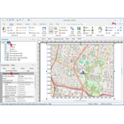
Specify the coordinate system for the entire map frame: In Properties – Map, set the coordinate system for drawing the entire map.
catalog(1)
Download All Catalogs
Company information

Even in a rapidly changing world, the philosophy of HuLinks has not changed since its founding. The greatness of humanity lies in our ability to think, create, and carve out a new tomorrow. We aim to contribute to society by providing carefully selected solutions that support this remarkable human ability—intellectual creation—while also offering a more comfortable environment and enhancing productivity.