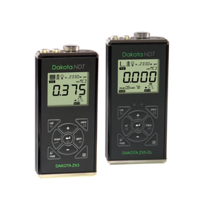
Ultrasonic Thickness Gauge 'ZX-3 / ZX-5 Series' Mid-Range
A mid-range thickness gauge equipped with a variety of functions that supports all types of measurements with a 5-level sensitivity adjustment feature.
This is a general model of an ultrasonic thickness gauge equipped with excellent basic performance and a variety of functions. In addition to a measurement range of 0.63mm to 1,000mm, it features automatic zero-point adjustment, single-point and dual-point calibration functions, and a five-level sensitivity adjustment function. In scan mode, it performs high-speed scanning at 100 times per second and displays the minimum thickness when the transducer is lifted. The ZX-5 / ZX-5DL includes alarm mode, differential thickness measurement mode, sound velocity measurement mode, and USB power supply capability. The ZX-5DL can store up to 10,000 measurement values in the main unit. ■ Features - Overwhelming measurement range of 0.63mm to 800mm (equivalent to steel) - Five-level sensitivity adjustment function - Screen updates at 10 times per second, and ultra-fast measurements at 100 times per second in scan mode - Optimally sized for Japanese users, lightweight design for comfortable long-term inspections - IP65 dustproof and drip-proof performance with a 5-year warranty *For more details, please refer to the PDF document or contact us.
- Company:ダコタ・ジャパン
- Price:100,000 yen-500,000 yen


![N2 Gas Station NC-100R [Free demo unit available for loan]](https://image.mono.ipros.com/public/product/image/448/2000049197/IPROS45844412244621981895.jpeg?w=280&h=280)
![Hot Air Rework Station XRS-100 [Free Demo Unit Available]](https://image.mono.ipros.com/public/product/image/28b/2000723711/IPROS93936479333084013704.jpeg?w=280&h=280)


