We have compiled a list of manufacturers, distributors, product information, reference prices, and rankings for Drone.
ipros is IPROS GMS IPROS One of the largest technical database sites in Japan that collects information on.

Drone Product List and Ranking from 104 Manufacturers, Suppliers and Companies | IPROS GMS

Last Updated: Aggregation Period:Aug 19, 2026~Sep 15, 2026
This ranking is based on the number of page views on our site.

Drone Manufacturer, Suppliers and Company Rankings

Last Updated: Aggregation Period:Aug 19, 2026~Sep 15, 2026
This ranking is based on the number of page views on our site.

  1. Liberaware Chiba//robot
  2. トピア 本社工場、名古屋事業所、神奈川事業所、埼玉営業所、神奈川営業所 Mie//Automobiles and Transportation Equipment
  3. JOHNAN 本社 Kyoto//Industrial Machinery
  4. 4 ブルーイノベーション Tokyo//robot
  5. 5 アイティーシム Kanagawa//Trading company/Wholesale

Drone Product ranking

Last Updated: Aggregation Period:Aug 19, 2026~Sep 15, 2026
This ranking is based on the number of page views on our site.

  1. Ultra-narrow space inspection drone "IBIS2" Liberaware
  2. Drone manufactured using carbon molding technology *Exhibited at Drone Expo 2026 トピア 本社工場、名古屋事業所、神奈川事業所、埼玉営業所、神奈川営業所
  3. FA Marketplace - A flea market site specializing in FA equipment. JOHNAN 本社
  4. 4 About exterior wall inspections using drones. ドローン・フロンティア
  5. 5 Domestic Robot AMR 'WILL-FA' ciRobotics 曲事業所

Drone Product List

151~180 item / All 298 items

Displayed results

Daitect Box SD

Introducing a washable SDGs support box that can be used continuously while being considerate of the environment!

The "Daitect Box SD" is an easily recyclable box that does not use pins or adhesives. It is easy to clean and can be reused, with custom designs for "length, width, and height." Depending on your desired size, we can offer four models: "SD-I," "SD-II," "SD-III," and "SD-IV." 【Features】 ■ Easy to clean and reusable ■ Does not use pins or adhesives ■ Easily recyclable ■ Custom designs for "length, width, and height" ■ Leak-proof for water, powder, oil, etc. *For more details, please refer to the PDF document or feel free to contact us.

  • Storage
  • container
  • Drone

Added to bookmarks

Bookmarks list

Bookmark has been removed

Bookmarks list

You can't add any more bookmarks

By registering as a member, you can increase the number of bookmarks you can save and organize them with labels.

Free membership registration

Ditec Box KD Hybrid

Custom-made with free design of 'length × width × height'! Introducing the transparent box.

The "Daitect Box KD Hybrid" is a convenient and beautiful free-size box that can be stacked. It is a see-through box that allows you to see the contents, and printing is possible on the frame. This product is designed to be long-lasting while being environmentally friendly. 【Features】 ■ Environmentally friendly and long-lasting ■ See-through box ■ Can be stacked, convenient and beautiful ■ Custom-made with free design for "length × width × height" ■ Stacking is allowed ■ Printing is possible on the frame *For more details, please refer to the PDF materials or feel free to contact us.

  • Storage
  • container
  • Drone

Added to bookmarks

Bookmarks list

Bookmark has been removed

Bookmarks list

You can't add any more bookmarks

By registering as a member, you can increase the number of bookmarks you can save and organize them with labels.

Free membership registration

<1 Month Free Trial Now Available> Smart Attack

Streamline on-site reporting smartly! Turn your smartphone into a data HUB for field operations.

"Smart Attack" is a field reporting app that allows for easy reporting via smartphone. You can check the work location on a map app, and by simply entering the report details and photos, a report can be easily completed! We offer a one-month free trial, and we also provide sample templates tailored to different usage purposes. You can try it out immediately, and it can be used with the Excel forms you are currently using. You can apply through the related links below, so please take this opportunity to give it a try. 【Features】 ■ Utilize your current Excel forms as they are, and create reports smartly with the app ■ Real-time field instructions and reporting that ensure accuracy ■ Flexible and scalable, capable of integration with other systems ■ Compatible with iOS/Android, and can also be used on tablets *Please apply for the trial through the "Related Links" below.

  • Embedded applications for mobile phones and PDAs
  • Drone

Added to bookmarks

Bookmarks list

Bookmark has been removed

Bookmarks list

You can't add any more bookmarks

By registering as a member, you can increase the number of bookmarks you can save and organize them with labels.

Free membership registration

Field report app 'Smart Attack' makes reporting easy on your smartphone.

Real-time generation and sharing of reports and data from your smartphone. Even easier to use with the renewal!

The on-site reporting app "Smart Attack" is an application that allows users to easily generate and share forms and data using smartphones and tablets. By simply reporting from a smartphone, forms are automatically generated and shared in real-time, enhancing operational efficiency. With integration with map services, confirming work locations is also easy, and features like AI meter reading and scheduling can be utilized. 【Features】 ■ A proven track record across a wide range of industries for 14 years ■ Ability to register and confirm work locations through integration with map services ■ Utilization of AI meter reading and scheduling features ■ Compatible with Android/iOS ■ Can also be used by contracting companies and others *For more details, please refer to the catalog or feel free to contact us. ★ With the arrival of the new version, functionalities and UI have been improved, making it even easier to use! Detailed information is provided in the information section. Please take a look.

  • Embedded applications for mobile phones and PDAs
  • Drone

Added to bookmarks

Bookmarks list

Bookmark has been removed

Bookmarks list

You can't add any more bookmarks

By registering as a member, you can increase the number of bookmarks you can save and organize them with labels.

Free membership registration

【Smart Attack Utilization Points】~Rounder Operations Edition~

Marketing research and legal compliance checks for stores and products have become super efficient!

Introducing the utilization methods and key points of the field report app "Smart Attack" in rounder operations. ★★ Streamline rounder business reports with "Smart Attack"! ★★ ■ Benefits for Workers 1. Schedules can be registered all at once, and inspection contents and reports can be registered as templates for each store. 2. The past reference function allows checking of previous records and those of predecessors. Reports can be sent in real-time from the field. ■ Benefits for Administrators 1. The "GPS photo" and "location information acquisition" functions record tamper-proof photos and timestamps, with alerts for discrepancies in work locations for easy verification. 2. After reporting from the field, administrators can verify in real-time. The system can be used by related vendors, allowing for immediate identification of deficiencies, speeding up responses, and improving customer satisfaction. ★★ User Feedback ★★ - I can register visit schedules along with templates for each store all at once, so there’s no chance of mixing up the inspection contents for each store. - Aggregation management has become easier. It can be automated with macros and RPA integration. - There’s no chance of mixing up photos. *For more details, please refer to the "Related Links" below or feel free to contact us.

  • Other production management systems
  • Drone

Added to bookmarks

Bookmarks list

Bookmark has been removed

Bookmarks list

You can't add any more bookmarks

By registering as a member, you can increase the number of bookmarks you can save and organize them with labels.

Free membership registration

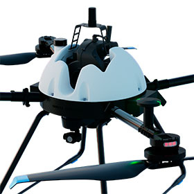
4-hour long flight hybrid drone "GLOW.H" - AOS

Achieving an overwhelming flight time of 4 hours, a domestically produced hybrid drone equipped with a Japanese-made range extender.

A hybrid drone equipped with an extender developed to extend the range of electric vehicles. It can fly for extended periods by charging its built-in battery with an engine. It can fly for 4 hours without a payload and for 2 hours when equipped with the drone laser system "TDOT" series. You can conduct extensive surveys at once without worrying about running out of battery. Operation requires only refueling with mixed gasoline. The tasks of charging and replacing batteries, which hindered work efficiency, are eliminated, significantly improving the labor-saving of on-site operations. The extender uses a domestically produced compact extender developed by Ogawa Seiki Co., Ltd., which combines durability and quietness. Domestic support is available for everything from the supply of consumables to maintenance. ■ Equipped with Pixhawk flight controller ■ Standard GLOW dedicated control application Supports autopilot without know-how. Centralized management of cumbersome flight logs ■ Standard support for LTE Assists remote operation in areas without radio communication ■ Standard equipped with NVIDIA JETSON Capable of unique processing such as AI machine learning, high-load image processing, and autonomous driving systems.

  • Distance measuring device
  • Drone

Added to bookmarks

Bookmarks list

Bookmark has been removed

Bookmarks list

You can't add any more bookmarks

By registering as a member, you can increase the number of bookmarks you can save and organize them with labels.

Free membership registration

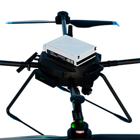
Intelligence Battery Domestic Drone "GLOW.L" - AOS

Excellent portability and significantly improved mobility. Standard platform for industrial drones.

GLOW.L is an industrial drone that utilizes a highly reliable domestically produced intelligence battery. It is designed to eliminate unnecessary components needed for the sensors mounted on the drone, optimizing the weight reduction and weight balance of the airframe, enabling programmed stable flight. Equipped with the drone laser scanner system "TDOT" series, it can achieve approximately 25 minutes of flight time. It is a compact, foldable design that is convenient for transport. You can easily take it to the site, and simply unfold and lock the foldable arms to complete the flight preparation. No tools are required, so you can be ready to fly immediately upon arrival at the site. ■ Equipped with Pixhawk flight controller ■ Comes standard with a dedicated GLOW control application Supports automatic piloting without any know-how. Manages tedious flight logs centrally. ■ Standard support for LTE Assists remote operation in areas without radio communication coverage ■ 5kg payload Equipped with a quick release for easy attachment and detachment of the TDOT series.

  • Distance measuring device
  • Drone

Added to bookmarks

Bookmarks list

Bookmark has been removed

Bookmarks list

You can't add any more bookmarks

By registering as a member, you can increase the number of bookmarks you can save and organize them with labels.

Free membership registration

Facility inspection using drones for factory and building exterior walls.

No need for scaffolding or high-altitude work. Safe aerial overview photography and shooting from outside the explosion-proof area.

We will introduce the use of drones for facility inspections of factory and building exterior walls. By changing the onboard equipment, such as optical zoom cameras and infrared cameras, we can accommodate various inspections. It is also suitable for capturing an overview from above. Additionally, by using scan data from LiDAR and software to create 3D models, we can check the condition of the exterior walls from angles that are impossible to assess from the ground. 【Features】 ■ Clear images can be obtained even when flying from a distance using optical zoom ■ There are many applications for modeling creation and more ■ Infrared camera imaging can be utilized to detect anomalies ■ It is possible to capture images from outside a hazardous area into the hazardous area using an optical 30x zoom camera *For more details, please refer to the PDF document or feel free to contact us.

Added to bookmarks

Bookmarks list

Bookmark has been removed

Bookmarks list

You can't add any more bookmarks

By registering as a member, you can increase the number of bookmarks you can save and organize them with labels.

Free membership registration

Inspection of tanks and boiler equipment using indoor inspection drones.

No need for scaffolding or high-altitude work! Clear images can be captured even in dark, dusty environments.

We will introduce the inspection of tank and boiler facilities using indoor inspection drones. For inspecting large tanks and boilers, we use the ELIOS 3, which is equipped with lighting of up to 16,000 lumens. It can capture clear images even in completely dark environments filled with dust, and the camera can be tilted up and down, allowing for the inspection of roof beams. Additionally, since the interior of tanks and boilers is a hazardous area, entering them poses significant risks. However, by using drones, we can achieve safe inspections from a distance. 【Features】 ■ ELIOS 3 can emit up to 16,000 lumens of light ■ No need for additional lights even in completely dark spaces ■ The Matrice series, suitable for outdoor inspections, can capture clear images even when flying from a distance using optical zoom ■ Clear images can be obtained even in dark and dusty environments ■ The camera angle can be adjusted up and down, allowing for the inspection of roof beams *For more details, please refer to the PDF document or feel free to contact us.

Added to bookmarks

Bookmarks list

Bookmark has been removed

Bookmarks list

You can't add any more bookmarks

By registering as a member, you can increase the number of bookmarks you can save and organize them with labels.

Free membership registration

Inspection of pipes and sewers using indoor inspection drones.

Even in non-GPS environments! Flight is possible while automatically controlling with sensors.

We will introduce the use of indoor inspection drones for pipe and sewer inspections. Since we have adopted a spherical guard that does not pose a problem when in contact with pipe walls, it is safe to work even when passing through narrow manholes. The drone can fly in non-GPS environments where conventional drones cannot, using sensors for automatic control during flight. Additionally, it not only avoids the risk of toxic gases to workers but also reduces inspection time from 2 days to 4 hours. 【Features】 - Eliminates the risk of toxic gases from inspectors entering the area, resulting in discoveries of piping not shown on blueprints. - The spherical guard allows for safe passage through narrow manholes, even if contact occurs. - By adjusting the intensity and angle of illumination, it is possible to check for issues such as peeling paint. - Capable of flying in environments where GPS signals are unavailable or where flying poses risks due to narrow spaces. *For more details, please refer to the PDF document or feel free to contact us.

Added to bookmarks

Bookmarks list

Bookmark has been removed

Bookmarks list

You can't add any more bookmarks

By registering as a member, you can increase the number of bookmarks you can save and organize them with labels.

Free membership registration

Inspection of bridge facilities and equipment using indoor inspection drones.

By utilizing it easily and safely, it leads to overall efficiency! Cost reduction is also possible.

We will introduce the inspection of bridge facilities and equipment using indoor inspection drones. Traditional bridge inspection methods using inspection vehicles or ropes require nighttime inspection work, road restrictions, and traffic regulation costs. By conducting inspections with drones, the preparation time is reduced, and by utilizing them easily and safely, overall efficiency can be improved, leading to cost reductions. 【Features】 - It is possible to access the bearing section from between the girders to check the mortar, bridge seat surface, anchor bolts, etc. - Although there are many dark areas inside and beneath the girders, sufficient illumination can be secured by using the ELIOS 3. *For more details, please refer to the PDF document or feel free to contact us.

Added to bookmarks

Bookmarks list

Bookmark has been removed

Bookmarks list

You can't add any more bookmarks

By registering as a member, you can increase the number of bookmarks you can save and organize them with labels.

Free membership registration

Portable Drone Port for Disaster Situations

Support for rapid disaster response! Adoption of a unique VIS (Port Information Management System).

The portable drone port for disaster response supports rapid disaster management. It acquires and monitors the operational status of drones that automatically take off from supply transport bases, and in the event of an anomaly, emergency stop measures and manual intervention are possible. During disasters, drone transport that is unaffected by road blockages can be conducted with the minimum necessary system and personnel, enabling faster delivery of relief supplies and reducing the burden of operations, ultimately providing prompt safety and security to local residents. 【Features】 ■ Automatic transmission and sharing of disaster area information from the drone port ■ Application and acceptance of relief supplies and pre-flight preparations ■ Automated transport of supplies by drone *For more details, please refer to the PDF document or feel free to contact us.

Added to bookmarks

Bookmarks list

Bookmark has been removed

Bookmarks list

You can't add any more bookmarks

By registering as a member, you can increase the number of bookmarks you can save and organize them with labels.

Free membership registration

[Case Study] Improving Efficiency and Advancement of Operations through Drone Inspections

Stable flight even in special environments such as non-GPS areas, dark places, and confined spaces!

Since 2019, Kyushu Electric Power has been utilizing "ELIOS" for boiler inspections at thermal power plants, internal chimney inspections, and bridge inspections to improve operational efficiency within the company. Furthermore, for external customers, in addition to internal chimney and bridge inspections, "ELIOS" is being used for various infrastructure inspections such as duct interiors and waterways, achieving numerous results. "ELIOS," which can fly stably even in special environments such as non-GPS areas, dark places, and confined spaces, has a high operational rate among the many aircraft owned by Kyushu Electric Power and is an indispensable aircraft. *For more details, please refer to the PDF document or feel free to contact us.*

Added to bookmarks

Bookmarks list

Bookmark has been removed

Bookmarks list

You can't add any more bookmarks

By registering as a member, you can increase the number of bookmarks you can save and organize them with labels.

Free membership registration

[Case Study] Drone inspection significantly reduced the inspection time for buried piping from "5 days to 2 hours."

On-site work completed in about 2 hours! It is possible to check for any damage that requires repair before cleaning.

We would like to introduce a case where Idemitsu Kosan's Tokuyama Plant used our "ELIOS2" for inspecting buried piping. In the entrance inspection of the buried piping used for cooling seawater in plant facilities, there was a problem that it required about five days of cleaning before starting visual inspections, which delayed the confirmation of damages that needed repairs. By using "ELIOS2," it became possible to check for damages requiring repairs before cleaning the buried seawater piping, and the on-site work was completed in about two hours. [Case Summary] ■Challenges - Approximately five days of cleaning time is required before starting visual inspections. - Delays in confirming damages. ■Results - Able to confirm the presence of damages requiring repairs before cleaning. - On-site work was completed in about two hours. *For more details, please refer to the PDF document or feel free to contact us.

Added to bookmarks

Bookmarks list

Bookmark has been removed

Bookmarks list

You can't add any more bookmarks

By registering as a member, you can increase the number of bookmarks you can save and organize them with labels.

Free membership registration

Bridges inspection drones listed in the Ministry of Land, Infrastructure, Transport and Tourism's "Inspection Support Technology Performance Catalog."

Create high-precision three-dimensional models! It is possible to check the shape even in areas that people cannot visit.

The bridge inspection technology utilizing our "ELIOS 3" has been featured in the Ministry of Land, Infrastructure, Transport and Tourism's "Inspection Support Technology Performance Catalog." With the LiDAR equipped in this product, we can acquire three-dimensional data and create high-precision three-dimensional models of the interiors of boilers and factories. By creating three-dimensional models, we can quickly confirm layouts when making changes to production line configurations. 【Features】 ■ The LED light has an illuminance of 16,000lm, allowing it to brightly illuminate even the widest and darkest spaces. ■ The camera can tilt directly up and down. ■ There is minimal reflection from the guard, enabling stable photography of ceiling beams and other structures. ■ There is a low risk of damage from contact with equipment. ■ Photogrammetry is also possible with the equipped camera. *For more details, please refer to the PDF document or feel free to contact us.

Added to bookmarks

Bookmarks list

Bookmark has been removed

Bookmarks list

You can't add any more bookmarks

By registering as a member, you can increase the number of bookmarks you can save and organize them with labels.

Free membership registration

[Technical Introduction] Bridge Inspection Technology Utilizing the Inspection Drone "ELIOS 3"

Stable flight even in environments where GPS does not work! It is possible to identify the location of defects such as cracks.

We would like to introduce our spherical inspection drone "ELIOS 3" and its bridge inspection technology. Due to its spherical guard and collision resistance, it can enter narrow spaces for filming. Additionally, by utilizing SLAM technology, it can fly stably even in environments where GPS is ineffective, such as under girders and box girders. 【Features】 ■ Stable flight in GPS-denied environments thanks to SLAM technology ■ Capable of entering narrow spaces for filming due to spherical guard and collision resistance ■ Equipped with a camera that can tilt 180° up and down, allowing for filming of the top surface of deck slabs ■ Capable of filming in dark areas with a 16,000-lumen LED light ■ Able to identify the location of defects such as cracks *For more details, please refer to the PDF document or feel free to contact us.

Added to bookmarks

Bookmarks list

Bookmark has been removed

Bookmarks list

You can't add any more bookmarks

By registering as a member, you can increase the number of bookmarks you can save and organize them with labels.

Free membership registration

Selectable Drone Insurance [Coverage for Drone Aircraft | Liability Coverage]

For safe and secure drone operations! Supporting your drone operations.

We would like to introduce Blue Innovation Inc.'s "Selectable Drone Insurance." We offer "Drone Insurance for SORAPASS members" for drone body coverage and "SORAPASS care" for liability coverage. Through various insurance options prepared for unforeseen circumstances, we support your drone operations. 【Features of Drone Insurance for SORAPASS Members】 ■ Available for individuals ■ No manufacturer restrictions ■ Peace of mind even when lending out the drone ■ Three selectable plans ■ Quick start of coverage ■ Easy online application *For more details, please refer to the PDF document or feel free to contact us.

Added to bookmarks

Bookmarks list

Bookmark has been removed

Bookmarks list

You can't add any more bookmarks

By registering as a member, you can increase the number of bookmarks you can save and organize them with labels.

Free membership registration

[Drone Body Insurance] Drone insurance that provides peace of mind even when lending out the aircraft.

All drones from manufacturers sold in Japan are included.

This is an insurance for drones that compensates for damages caused by sudden accidents (such as fire, theft, or collision with objects) that occur while you own the drone. It also covers accidents that happen when the drone is lent out, allowing for comparison based on the content and insurance premiums, so you can enroll without waste. The entire process from estimate to application can be completed online. 【Features】 ■ Available for individuals ■ No manufacturer restrictions ■ Peace of mind when lending out the drone ■ Three plans to choose from ■ Quick start of coverage ■ Easy online application *For more details, please download the PDF or feel free to contact us.

  • Other inspection equipment and devices
  • Drone

Added to bookmarks

Bookmarks list

Bookmark has been removed

Bookmarks list

You can't add any more bookmarks

By registering as a member, you can increase the number of bookmarks you can save and organize them with labels.

Free membership registration

Indoor inspection drone "ELIOS 3"

For inspections of facilities that are difficult for people to access. 3D modeling of point cloud data obtained with LiDAR is also possible.

The "ELIOS 3" is a drone that efficiently performs inspection tasks in hard-to-reach areas by utilizing LiDAR sensors and SLAM technology. It scans the surroundings with a LiDAR sensor to create a high-density point cloud map, which is displayed in real-time on the operator's tablet along with captured images. Integration with GeoSLAM's software package enables the creation of detailed point cloud data (3D modeling). 【Features】 - Stable flight unaffected by surrounding conditions or environments thanks to SLAM technology - Ability to create reports on 3D models in collaboration with the dedicated software "Inspector" - Equipped with a camera that can tilt 180° and an LED light with a maximum of 16,000 lumens - Contributes to improved safety in inspection work and enhances the efficiency of facility operation and management *For more details, please refer to the materials. Feel free to contact us with any inquiries.

  • Inspection robot
  • Drone

Added to bookmarks

Bookmarks list

Bookmark has been removed

Bookmarks list

You can't add any more bookmarks

By registering as a member, you can increase the number of bookmarks you can save and organize them with labels.

Free membership registration

Aerial Weather Observation Drone "R-SWM"

Introducing a drone that enables aerial weather observations at any altitude and any latitude/longitude!

The "R-SWM" is a drone equipped with technology capable of observing true wind direction and speed for upper atmospheric weather observation. It is equipped with a weather observation device that can be bolt-on to the Mini Surveyor. Real-time data can be monitored and recorded on the ground using dedicated software. It can be used for preliminary surveys and post-verification during wind power generation planning, as well as for upper atmospheric weather observation from a drone control tower. 【Features】 - Weather observation device that can be bolt-on to the Mini Surveyor - Observation elements include 5 factors (wind direction, wind speed, temperature, humidity, atmospheric pressure) *All can obtain certification from the Japan Meteorological Agency - Continuous weather observation powered by a separate power source (square dry batteries) - Transmission unit with memory (1-second recording) - Ground station can record and monitor real-time weather data - Weight approximately 1.2 kg (transmitter + weather instrument + ancillary parts) *For more details, please refer to the PDF document or feel free to contact us.

  • Other safety equipment
  • Other measurement, recording and measuring instruments
  • others
  • Drone

Added to bookmarks

Bookmarks list

Bookmark has been removed

Bookmarks list

You can't add any more bookmarks

By registering as a member, you can increase the number of bookmarks you can save and organize them with labels.

Free membership registration

[Case Study] Proposal for Equipment Inspection Using Drones

By knowing the damage situation in advance, it becomes possible to confirm the general scope of repairs and costs!

A customer in the building materials manufacturing industry was experiencing rain leaks due to the aging roof of their factory building, which was deteriorating the indoor working environment. To establish a repair plan, it was necessary to assess the current condition of the roof in advance. However, inspecting the roof required working at heights, which led to various issues. As a solution, drone photography was used to conduct the roof inspection. As a result, workers were able to check the condition of the roof without having to go up to high places, eliminating the need to set up scaffolding, which is both costly and time-consuming. 【Overview】 ■ Issues - Conducting high-altitude inspection work without scaffolding violates safety rules. - Scaffolding must be erected for safety measures, but it incurs excessive costs. - There is not enough time to secure the construction period for setting up and removing scaffolding. ■ Implementation Effect - The condition of the roof can be checked without the need for costly and time-consuming scaffolding. *For more details, please refer to the PDF document or feel free to contact us.

  • Other services
  • Drone

Added to bookmarks

Bookmarks list

Bookmark has been removed

Bookmarks list

You can't add any more bookmarks

By registering as a member, you can increase the number of bookmarks you can save and organize them with labels.

Free membership registration

Must-see for those who want to move hundreds of kilograms in Okayama: Heavy cargo transportation

Leave the handling, transportation, relocation, and removal of precision machinery and heavy objects to us!

Nakau Corporation specializes in the transportation of heavy goods. We handle a variety of equipment, from facility equipment (kitchen equipment, medical devices, printing machines, etc.) to machine tools and production lines, with full responsibility for our work. Even if you think that loading and unloading may be difficult, please feel free to consult with us. 【Features】 ■ Loading and unloading: Using crane trucks and special equipment ■ Installation: Marking, leveling, anchoring, etc. ■ Relocation: Possible from single items to entire sets, including on-site relocation without transportation ■ Removal: Loading, replacement, disposal item pickup, and handling of procedural documents *For more details, please refer to the PDF materials or feel free to contact us.

Added to bookmarks

Bookmarks list

Bookmark has been removed

Bookmarks list

You can't add any more bookmarks

By registering as a member, you can increase the number of bookmarks you can save and organize them with labels.

Free membership registration

[Production Example] Kyoto University Campus Drone Photography

Using drones and action cameras to capture the vast campus!

We received a request from Kyoto University for the production of English-language content aimed at international students, specifically for drone footage. In the production of the video, we researched overseas drone footage and innovated in filming and editing. In addition to using drones, we utilized action cameras to capture aerial footage and shots from a human perspective, experimenting with various angles to achieve dynamic visuals. 【Case Overview】 ■ Kyoto University ■ Drone filming of Kyoto University campus ■ Date: December 2021 ■ Customer Feedback - The drone filming and editing expressed the vastness and greenery of the campus that could not be captured through still images. - This contributed to enhancing the university's image, receiving high praise from both within and outside the university. *For more details, please refer to the PDF document or feel free to contact us.

Added to bookmarks

Bookmarks list

Bookmark has been removed

Bookmarks list

You can't add any more bookmarks

By registering as a member, you can increase the number of bookmarks you can save and organize them with labels.

Free membership registration

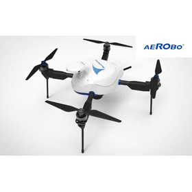
Domestic Drone: Aerobo (AS-MC03)

Specialized in photogrammetry and photo inspection! Equipped with a high-performance camera and image sensor that can capture distortion-free still images even while moving at high speeds.

The "AeroBo (AS-MC03)" is a drone suitable for surveying and inspection using photographs taken from the sky. It is equipped with a high-performance camera that can achieve high image quality even with a fast shutter speed, as well as a high-sensitivity image sensor. Additionally, it features a mechanical shutter mechanism that minimizes image distortion, enabling high-precision and reliable drone surveying. 【Features of AeroBo (AS-MC03)】 ■ High-performance camera with an APS-C size image sensor and interchangeable lenses, ideal for surveying ■ Automation of camera and route settings compliant with I-Construction standards ■ Robust for on-site operations, with waterproof, dustproof, and wind-resistant capabilities *For more details, please refer to the PDF document or feel free to contact us.

  • others
  • Drone

Added to bookmarks

Bookmarks list

Bookmark has been removed

Bookmarks list

You can't add any more bookmarks

By registering as a member, you can increase the number of bookmarks you can save and organize them with labels.

Free membership registration

2D Camera uEye USB3.0 LE - Drone

Embedded vision solution with USB 3.0 board-level camera.

Here are some use cases for the "USB 3.0 board-level camera." Drones can be utilized for various purposes during disasters, such as obtaining water quality samples, dropping lifelines, and providing geographical data and images from locations that are difficult or impossible for humans to access. In the last example, the AKAMAV team, a working group at Braunschweig University of Technology, developed a multirotor with special equipment under the university's support. This system consists of an ARM-based single-board computer and a "USB 3.0 board-level camera." [Overview] ■ Purpose of introduction: Aerial monitoring ■ Product introduced: USB 3 uEye LE series *For more details, please refer to the PDF document or feel free to contact us.

  • Other image-related equipment
  • Drone

Added to bookmarks

Bookmarks list

Bookmark has been removed

Bookmarks list

You can't add any more bookmarks

By registering as a member, you can increase the number of bookmarks you can save and organize them with labels.

Free membership registration

Drone business (surveying)

Easy to access even in hard-to-reach places like disaster sites and mountainous areas! Delivering survey data in a short period of time!

At the Moriyama Environmental Science Research Institute, we conduct surveys using drones to deliver safety and security for daily life from the sky. By analyzing photos taken by drones from above the site, we can measure the shape of the terrain. By analyzing hundreds of aerial photos and videos with a dedicated system, we create three-dimensional models of the target area. Additionally, drone-based surveys can be conducted with fewer personnel and can reach areas that are difficult to access, making them promising for use in the construction industry. 【Features】 ■ Easily grasp the overall picture of regions and structures even in hard-to-reach places ■ Survey data can be delivered in a short period ■ Survey results are provided as rich 3D data ■ Multiple pilots with approval from the Ministry of Land, Infrastructure, Transport and Tourism, who have undergone sufficient flight training ■ Also covered by liability insurance for property and personal injury *For more details, please refer to the external link page or feel free to contact us.

  • Other services
  • others
  • Drone

Added to bookmarks

Bookmarks list

Bookmark has been removed

Bookmarks list

You can't add any more bookmarks

By registering as a member, you can increase the number of bookmarks you can save and organize them with labels.

Free membership registration

Small industrial underwater drone 'FIFISH V6 EXPERT'

Maximum diving depth is 100 meters! Equipped with a 166° ultra-wide angle 4K lens and image enhancement processing function.

The "FIFISH V6 EXPERT" is an underwater drone designed for professionals. As a multifunctional and highly expandable underwater work tool, it enables safe and efficient underwater operations. Additionally, by using a multifunctional expansion interface, you can freely combine and use specialized option parts to efficiently carry out underwater tasks tailored to various application scenarios. 【Features】 ■ Long-lasting, balancing safety and high efficiency ■ Compact and easy to assemble ■ Excellent portability, simple and efficient ■ 166° ultra-wide 4K lens with enhancement processing capabilities ■ 6000 lumens LED *For more details, please refer to the PDF materials or feel free to contact us.

Added to bookmarks

Bookmarks list

Bookmark has been removed

Bookmarks list

You can't add any more bookmarks

By registering as a member, you can increase the number of bookmarks you can save and organize them with labels.

Free membership registration

Edge drone

Advanced route settings are possible! We also implement advanced security measures.

The "Edge Drone" is a solution that incorporates edge computing-based IoT integration software with AI capabilities in the flight controller. This product is equipped with essential features for a safe and secure drone system, including "advanced maneuvering," "security measures," and a "flexible platform." Additionally, we offer an "agricultural spraying drone" that reduces the time required for pesticide application. 【Main Features of Edge Drone】 ■Automatic flight ■Autonomous photography ■Obstacle avoidance ■Automatic route planning ■Security measures *For more details, please refer to the PDF document or feel free to contact us.

  • Color camera
  • Drone

Added to bookmarks

Bookmarks list

Bookmark has been removed

Bookmarks list

You can't add any more bookmarks

By registering as a member, you can increase the number of bookmarks you can save and organize them with labels.

Free membership registration

Aerial drone "Build Flyer" for surveying and more!

Domestic development and manufacturing with peace of mind and trust! By incorporating an ESC, we improve heat dissipation and protect the ESC.

The "Build Flyer" is a surveying and aerial photography drone that enhances trust and precision, achieving tough flights. By incorporating an ESC, heat dissipation is improved, protecting the ESC. By using lightweight magnesium, a practical metal, strength, rigidity, and weather resistance have been significantly increased. 【Features】 ■ Compact storage ■ Gimbal attachment ■ Ingenious battery ■ High security ■ Adoption of ultra-lightweight magnesium alloy and ESC-integrated arms *For more details, please refer to the PDF document or feel free to contact us.

  • Other weight measuring instruments
  • Drone

Added to bookmarks

Bookmarks list

Bookmark has been removed

Bookmarks list

You can't add any more bookmarks

By registering as a member, you can increase the number of bookmarks you can save and organize them with labels.

Free membership registration

Features of the Build Flyer: Long flight time

It has been designed to be useful for time-consuming tasks such as inspections and surveys!

The "Build Flyer" is a surveying and aerial photography drone capable of long-duration flights. It features a thorough reduction in airframe weight, optimized thrust efficiency, and is equipped with a large-capacity battery. It can be utilized for time-consuming tasks such as wind power inspection, laser surveying, photogrammetry, and disaster site investigations. 【Features】 ■ Payload: 5kg - 25 minutes of continuous flight ■ No load: 45 minutes of continuous flight ■ Battery capacity (mAh): 22,000 x 2 ■ Thorough reduction in airframe weight / Optimized thrust efficiency / Equipped with a large-capacity battery ■ Performance suitable for time-consuming tasks such as inspections and surveying *For more details, please refer to the PDF document or feel free to contact us.

  • Other measurement, recording and measuring instruments
  • Drone

Added to bookmarks

Bookmarks list

Bookmark has been removed

Bookmarks list

You can't add any more bookmarks

By registering as a member, you can increase the number of bookmarks you can save and organize them with labels.

Free membership registration

Search Keywords Related to Drone