

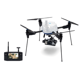
Application: Surveying and Aerial Photography Drone "Build Flyer"
For those who want to observe the same thing regularly: Introduction to features suitable for surveying and aerial photography, such as 'autonomous flight' and 'home return function'.
Introducing the application of the "Build Flyer," a drone for surveying and aerial photography. In automatic navigation, it is possible to instruct the drone to sequentially follow specific points along a designated route. You can also specify actions such as takeoff and landing at points, hovering, and triggering the camera shutter, allowing for flights suitable for surveying and aerial photography. Additionally, it features a home return function, automatic takeoff and landing capabilities, and fail-safe functions. 【Applications】 ■ Automatic navigation ■ Home return function ■ Automatic takeoff and landing function ■ Fail-safe function (when battery level reaches 30%, the legs enter landing mode and the drone automatically returns home) *For more details, please refer to the PDF document or feel free to contact us.
- 企業:アイティーシム
- 価格:Other


![Disaster Response Speaker-Compatible Drone [Build Flyer Chrome]](https://image.mono.ipros.com/public/product/image/838/2001073598/IPROS65847028139277972904.png?w=280&h=280)


![[Information] About the Necessity of Industrial Multi-Rotor Schools](https://image.mono.ipros.com/public/product/image/f14/2000476534/IPROS50355276322565027314.png?w=280&h=280)


![[Equipment Inspection and Measurement Service] Compact Drone 'IBIS' for Narrow Spaces](https://image.mono.ipros.com/public/product/image/926/2000583547/IPROS61941502064890808885.png?w=280&h=280)


