We have compiled a list of manufacturers, distributors, product information, reference prices, and rankings for Laser scanner.
ipros is IPROS GMS IPROS One of the largest technical database sites in Japan that collects information on.

Laser scanner Product List and Ranking from 64 Manufacturers, Suppliers and Companies | IPROS GMS

Last Updated: Aggregation Period:Aug 19, 2026~Sep 15, 2026
This ranking is based on the number of page views on our site.

Laser scanner Manufacturer, Suppliers and Company Rankings

Last Updated: Aggregation Period:Aug 19, 2026~Sep 15, 2026
This ranking is based on the number of page views on our site.

  1. null/null
  2. amuse oneself.Inc Osaka//Industrial Electrical Equipment
  3. 有限会社エムティプレシジョン Tokyo//Optical Instruments
  4. 4 シーズプロジェクト Shizuoka//Service Industry
  5. 5 横浜測器 本社 Kanagawa//Trading company/Wholesale

Laser scanner Product ranking

Last Updated: Aggregation Period:Aug 19, 2026~Sep 15, 2026
This ranking is based on the number of page views on our site.

  1. Safety Laser Scanner SZ-V Series
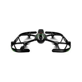
  2. Drone Laser Scanner System "TDOT 3 GREEN" amuse oneself.Inc
  3. Large-diameter pipe: 2D laser scanner for measuring the inner diameter of the pipe. 有限会社エムティプレシジョン
  4. 4 Solution achieved! Case studies of the Safety Laser Scanner "SZ Series"
  5. 5 Mobile SLAM laser scanner 'Hovermap' シーズプロジェクト

Laser scanner Product List

151~180 item / All 213 items

Displayed results

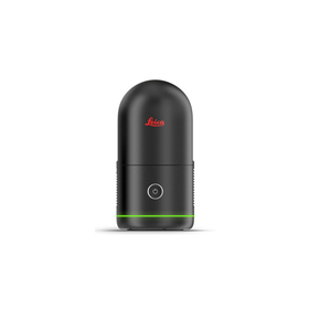
LEICA 3D Laser Scanner "BLK360 G2"

Lightweight and compact for easy portability! High-speed scanning of up to 680,000 points per second with simple operation.

The "BLK360 G2" can perform a full scan, including spherical images, in just 20 seconds, which is over five times faster than the conventional BLK360, with just the push of a button. The data from the BLK360 G2 is useful for a wide range of applications, from traditional architecture and construction to innovative VFX (visual effects) and VR (virtual reality). With a scanning speed of up to 680,000 points per second, it can measure up to 45 meters. Additionally, the data from the BLK360 G2 is beneficial for many applications, from traditional architecture and construction to innovative VFX and VR. For more details, please refer to the product catalog. 【Features】 ■ Lightweight, compact, and affordable 3D laser scanner ■ Easy operation with just the push of a button ★ We provide comprehensive support for the application process for manufacturing subsidies in collaboration with specialized consultants. Please feel free to contact us for more details. ★ Our company offers a variety of surveying equipment and systems, and we can provide proposals tailored to your needs. Please refer to the basic information section for examples of our products.

  • others
  • Laser scanner

Added to bookmarks

Bookmarks list

Bookmark has been removed

Bookmarks list

You can't add any more bookmarks

By registering as a member, you can increase the number of bookmarks you can save and organize them with labels.

Free membership registration

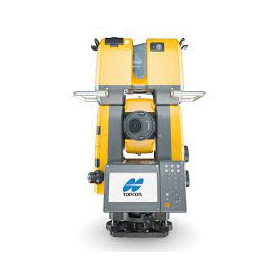
TOPCON: Laser Scanner 'GTL-1200'

Solve the challenges of 3D point cloud measurement with an on-site completion workflow!

【Features】 ■ Total station surveying and laser scanning measurements can be performed with one device ■ Point cloud density is twice that of conventional machines ■ Ideal for construction management using BIM ■ Highly effective for civil engineering, surveying, and maintenance management ■ Equipped with the onboard program MAGNET Field ■ Includes a Wi-Fi module ■ Remote operation via Collage Site is also possible *For more details, please refer to the PDF document or feel free to contact us.

  • others
  • Laser scanner

Added to bookmarks

Bookmarks list

Bookmark has been removed

Bookmarks list

You can't add any more bookmarks

By registering as a member, you can increase the number of bookmarks you can save and organize them with labels.

Free membership registration

Fully autonomous flying laser scanner "Leica BLK2FLY"

Orders will start in Japan from March 1, 2024! Fully autonomous flying laser scanner Leica BLK2FLY.

The "Leica BLK2FLY" can perform 3D scanning in hard-to-access places such as ceilings and roofs, both indoors and outdoors. It captures the exterior of buildings, structures, and environments, creating 3D point clouds while in flight. It can be activated with just a few taps on a tablet, allowing for aerial scanning of structures and environments. Aerial scanning is beneficial for cases that require accurate data from hard-to-reach or inaccessible locations, as it can fully capture the features and dimensions of a structure's exterior. 【Features】 - One-button operation - No calibration required for flight - Safe and stress-free flight enabled by obstacle detection - Easy creation of automatic flight plans from the operating application

  • others
  • Laser scanner

Added to bookmarks

Bookmarks list

Bookmark has been removed

Bookmarks list

You can't add any more bookmarks

By registering as a member, you can increase the number of bookmarks you can save and organize them with labels.

Free membership registration

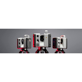
【2026 Latest Model】Leica RTC Series

Latest model announced in June 2026" - A ground-based laser scanner that enables "real-time data sharing during scanning.

The latest ground-based 3D laser scanner "Leica RTC500/700 Series" was announced by Leica Geosystems in June 2026. It overturns the conventional wisdom of "scanning on-site and checking data after returning to the office" in the fields of surveying, construction, and ICT civil engineering. With the industry's first new feature "Livelink," it seamlessly connects the field and the office, achieving overwhelming efficiency in surveying operations and reducing rework.

  • 3D measuring device
  • Laser scanner

Added to bookmarks

Bookmarks list

Bookmark has been removed

Bookmarks list

You can't add any more bookmarks

By registering as a member, you can increase the number of bookmarks you can save and organize them with labels.

Free membership registration

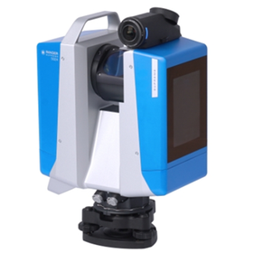
Ultra-high precision 3D laser scanner 'Z+F IMAGER 5024'

【Latest Model】Overwhelmingly low noise and ultra-high precision! A 3D laser scanner that excels in low-light measurements.

The "Z+F IMAGER 5024" is a state-of-the-art high-end 3D laser scanner manufactured by Z+F, a company that Germany proudly presents to the world. It employs a "phase-based (phase difference) method" that utilizes the wavelength of light to measure distances, achieving "extremely high precision in millimeter units" and "clear point cloud data with minimal noise" compared to conventional scanners. Additionally, with its built-in LED spotlight and high-performance HDR camera, it can generate vibrant data even in dark areas where light does not reach, such as behind tunnels and plant facilities. It also supports Z+F's unique field alignment system (Blue Workflow), completely preventing scanning omissions on-site and dramatically reducing data processing time after returning to the office.

  • 3D measuring device
  • Laser scanner

Added to bookmarks

Bookmarks list

Bookmark has been removed

Bookmarks list

You can't add any more bookmarks

By registering as a member, you can increase the number of bookmarks you can save and organize them with labels.

Free membership registration

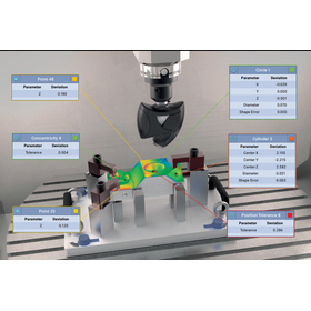
OPTISCAN MH

High-speed 3D scanning inside a 5-axis machining center! A high-precision laser sensor that changes the common sense of on-machine measurement.

【Onboard Measurement 3D Scanning Sensor: OptiScan-MH】 The OptiScan-MH is a cutting-edge onboard 3D laser scanner that achieves high performance and ultra-high precision measurements within machine tools. By collaborating with the dedicated software "M3MH," it generates an accurate digital copy (digital twin) of the entire surface of a part in just a few seconds within machining centers with up to 5 axes. Equipped with a red line laser, it rapidly acquires high-density 3D point cloud data from surfaces of various shapes and materials. Designed with a unique innovative structure that assumes operation in the harsh environments of machine tools, it also achieves high versatility. It smoothly accommodates major CNC control systems, including Fanuc, Siemens, and Heidenhain. Without removing the workpiece from the machining machine, it allows for on-site verification of the entire surface shape and high-precision positioning (setup), thoroughly eliminating rework and measurement bottlenecks. "Maximizing the potential of the machining room and leading the productivity and quality of the manufacturing process to the next stage" — that is the OptiScan-MH.

  • Optical Measuring Instruments
  • Laser scanner

Added to bookmarks

Bookmarks list

Bookmark has been removed

Bookmarks list

You can't add any more bookmarks

By registering as a member, you can increase the number of bookmarks you can save and organize them with labels.

Free membership registration

Introduction to 3D Laser Scanner Measurement Services

Three-dimensional measurement of the target object is possible in a "surface" manner!

Regional Development Co., Ltd. conducts 3D laser scanning measurement services that instantly capture three-dimensional coordinate (point cloud) data. Measurements can be taken from a distance without entering the measurement target area. This technology can be utilized in various fields such as the maintenance and management of cultural properties, bridges, rivers, and erosion control. 【Examples of Use】 ■ 3D Data of Bridges ■ 3D Data of Stone Walls ■ 3D Data of Disaster Sites ■ 3D Data of Cultural Heritage Buildings ■ 3D Data of Slopes, etc. *For more details, please download the PDF or feel free to contact us.

  • Other measurement, recording and measuring instruments
  • Laser scanner

Added to bookmarks

Bookmarks list

Bookmark has been removed

Bookmarks list

You can't add any more bookmarks

By registering as a member, you can increase the number of bookmarks you can save and organize them with labels.

Free membership registration

In the retail industry! Laser scanner 'MS7120 Orbit(R)'

Reads symbols at a speed of 1,120 scans per second! Significantly improves on-site work efficiency! Omni-directional laser scanner suitable for the retail industry.

The "MS7120 Orbit" is an omnidirectional laser scanner that provides innovative and comfortable solutions for retail stores with limited counter space. This compact, lightweight, and robust product emits 20 lasers (patented), making the center of the reading range very easy to identify. Additionally, it reads symbols at a speed of 1,120 scans per second, significantly improving on-site work efficiency. 【Features】 ■ 20 omnidirectional lasers ■ Optimized reading ■ Adjustable angle of the scanner head ■ Flash ROM ■ Automatic reading *For more details, please download the PDF or feel free to contact us.

  • Scanner
  • Laser scanner

Added to bookmarks

Bookmarks list

Bookmark has been removed

Bookmarks list

You can't add any more bookmarks

By registering as a member, you can increase the number of bookmarks you can save and organize them with labels.

Free membership registration

Az Build Modeling Services 3D Laser Scanner Measurement

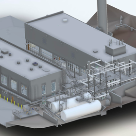
No drawings! Unable to understand the current state due to modifications! A 3D laser scanner to solve the design of factories, ruins, and ballast water treatment systems [Catalog available].

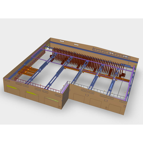
3D laser measurement is a pioneering technology for the upcoming era of 3D information. The data obtained using a 3D laser scanner, known as "point cloud," improves various operations for our customers. We propose low-cost, high-performance measurements tailored to your needs. Through point cloud synthesis and alignment, we provide high-quality point cloud data. Case Study: Plant When there are no 2D drawings or the current situation is unclear due to modifications, creating drawings using 3D measurement data is effective. Modeling and drawing through 3D measurement significantly reduces the cost of repair work. *For more details, please download the catalog or feel free to contact us.

  • Contract measurement
  • Other measurement, recording and measuring instruments
  • Other electronic measuring instruments
  • Laser scanner

Added to bookmarks

Bookmarks list

Bookmark has been removed

Bookmarks list

You can't add any more bookmarks

By registering as a member, you can increase the number of bookmarks you can save and organize them with labels.

Free membership registration

Intec Corporation Digital Scanner System Vol. 1

From the ultra-compact scanner head "2D-MSA-A10mini" to the 3-axis scanner head "Elevathor," we offer a variety of lineups!

This catalog introduces the "Digital Scanner System" handled by Intec Corporation, along with the "F-theta Scan Lens." The laser scanner system features high-speed scanning without cooling, as well as being compact and low power consumption. Additionally, it includes a 2-axis scanner head, scanner unit controller, and a 3-axis scanner head, making it a useful reference for those considering implementation. [Contents (excerpt)] ■ Digital Scanner System ■ 2-axis Scanner Head ■ Scanner Unit Controller ■ Elevator (3-axis Scanner Head) ■ Smart Deflector *For more details, please download the PDF or feel free to contact us.

  • others
  • Scanner
  • Laser scanner

Added to bookmarks

Bookmarks list

Bookmark has been removed

Bookmarks list

You can't add any more bookmarks

By registering as a member, you can increase the number of bookmarks you can save and organize them with labels.

Free membership registration

[Technology Introduction] Self-Localization and Environmental Mapping Technology 'SLAM'

Recognizing feature points in the images captured by the sensor! Based on that information, we estimate the position.

"SLAM" is a technology that estimates the position of a target equipped with this technology and simultaneously creates an environmental map based on that data. Even in environments where GPS signals cannot reach, it is possible to measure the distance between oneself and surrounding obstacles. Based on that information, it can avoid obstacles and move towards its destination. Therefore, it plays the role of "eyes" in fields such as automated transport robots and AR/VR/MR. 【Features】 ■ A technology that simultaneously performs self-position estimation of moving targets and environmental map creation ■ Measurable even in environments where GPS signals cannot reach ■ Can avoid obstacles and move to the destination based on information ■ Active in the fields of automated transport robots and AR/VR/MR as the role of "eyes" *For more details, please refer to the PDF document or feel free to contact us.

  • Other image-related equipment
  • Image Transmission Equipment
  • Distance measuring device
  • Laser scanner

Added to bookmarks

Bookmarks list

Bookmark has been removed

Bookmarks list

You can't add any more bookmarks

By registering as a member, you can increase the number of bookmarks you can save and organize them with labels.

Free membership registration

[Case Study Collection] GS-1

Introducing a case study interview on the implementation of GS-1!

You can download the interview article with customers who have introduced the GS-1. Case Study 1 【From point cloud acquisition to data processing shortened from 1 week to 1 day! Improvement in productivity】 ▶ Challenges before introduction All processes from point cloud acquisition to design data creation were outsourced, leading to high time and costs. ▶ Effects of introduction - The time from point cloud acquisition to data processing was reduced from about 1 week to about 1 day. - Awareness of point clouds within the company increased, promoting in-house production. Case Study 2 【Expanding possibilities! Aiming for further development of surveying technology】 ▶ Challenges before introduction - UAV laser had areas where the point cloud density was low, making it difficult to create current condition plans using only UAV laser. ▶ Effects of introduction - Areas that could not be measured with UAV laser were supplemented with GS-1. - Detailed measurements of vast areas were efficiently conducted using GS-1 in conjunction. - The options for surveying methods expanded.

  • 3D measuring device
  • Laser scanner

Added to bookmarks

Bookmarks list

Bookmark has been removed

Bookmarks list

You can't add any more bookmarks

By registering as a member, you can increase the number of bookmarks you can save and organize them with labels.

Free membership registration

CHCNAV RS10

A handheld 3D laser scanner that achieves precise measurements in real-time, both indoors and outdoors.

The RS10 is a high-precision handheld laser scanner that combines RTK, laser, and visual fusion technologies. It enables high-precision surveying in various environments, both indoors and outdoors. 【Fusion of RTK and SLAM】 - Real-time SLAM calculations with 5cm accuracy - Post-processing SLAM calculations with relative accuracy within 1cm RTK positioning accuracy is within 3cm, serving as a benchmark for SLAM mapping, ensuring 5cm accuracy in all environmental scenarios. 【Efficient workflow through loop-free operation】 Real-time calibration and loop-free route planning using high-precision RTK positioning data. 【Adaptability to dynamic environments】 【Same coordinate system from outdoors to indoors】 【Vi-LiDAR technology】

  • 3D measuring device
  • Laser scanner

Added to bookmarks

Bookmarks list

Bookmark has been removed

Bookmarks list

You can't add any more bookmarks

By registering as a member, you can increase the number of bookmarks you can save and organize them with labels.

Free membership registration

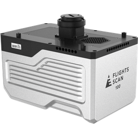
FLIGHTS SCAN 100

100 degrees, 1 million points, UAV-mounted laser scanner

The "FLIGHTS SCAN 100," which has debuted as a highly anticipated high-end model UAV-mounted laser scanner (LiDAR) in the FLIGHTS SCAN series, is equipped with a single-line sensor that boasts a 100-degree FOV and a maximum point cloud emission performance of 1 million points per second. It has achieved even more efficient acquisition of high-density point clouds with reduced thickness compared to previous models. Additionally, by utilizing it as a total solution alongside software services, it greatly contributes to further efficiency and precision in operations. We invite you to experience the unique usability that the FLIGHTS SCAN series offers.

  • 3D measuring device
  • Other measurement, recording and measuring instruments
  • Laser scanner

Added to bookmarks

Bookmarks list

Bookmark has been removed

Bookmarks list

You can't add any more bookmarks

By registering as a member, you can increase the number of bookmarks you can save and organize them with labels.

Free membership registration

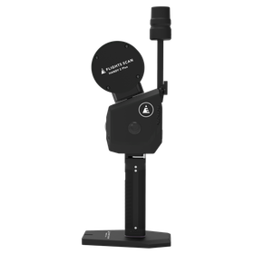
FLIGHTS SCAN HANDY 2 Plus

Next-generation high-end model that supports diverse environments.

The FLIGHTS SCAN HANDY 2 Plus is the highest-spec model in the series. Equipped with a laser sensor, a panoramic camera for 3DGS with three point cloud colorings, and a dual camera for Visual SLAM, this product boasts the highest performance in the series, enabling high-precision data acquisition in diverse environments. *As of January 2026.

  • Other electronic measuring instruments
  • Optical Measuring Instruments
  • Laser scanner

Added to bookmarks

Bookmarks list

Bookmark has been removed

Bookmarks list

You can't add any more bookmarks

By registering as a member, you can increase the number of bookmarks you can save and organize them with labels.

Free membership registration

Ideal for data acquisition in the maintenance and management field for various subjects!

Safely and efficiently with a 3D laser scanner! 3D measurement of various locations!

The "Fixed 3D Laser Scanner" is a surveying instrument that can instantly acquire 3D coordinate (point cloud) data of objects such as terrain and structures using lasers, without touching the measurement target. Unlike traditional "single point" measurements, it enables 3D surveying in a "surface" manner through high-precision and continuous high-speed acquisition of point cloud data. It allows for safe, efficient, and effective work in measuring the volume of structures, measuring the displacement of tunnel cross-sections, and recording measurements at archaeological sites, disaster areas, and accident scenes. 【Features】 ■ Instantly acquires 3D coordinate (point cloud) data ■ Enables 3D surveying in a "surface" manner ■ Applicable in various fields ■ Allows for safe, efficient, and effective work ■ Data is in a simple XYZ text format *For more details, please refer to the PDF document or feel free to contact us.

  • Other image-related equipment
  • Other measurement, recording and measuring instruments
  • Laser scanner

Added to bookmarks

Bookmarks list

Bookmark has been removed

Bookmarks list

You can't add any more bookmarks

By registering as a member, you can increase the number of bookmarks you can save and organize them with labels.

Free membership registration

3D data conversion of the factory, creation of records/modeling, acquisition of point cloud coordinate data.

The 3D chart includes all information about piping and equipment! You can easily access the information you want to reference through computer operations.

In the 3D digitization of GoodDot's factory, we create equipment records to facilitate smooth equipment management in factories that often undergo expansions and renovations. Using 3D scanner cameras, we quickly and accurately measure a variety of items, from large equipment to machine parts, buildings, and heritage sites. The records include all information about piping and equipment, allowing for easy access to the desired information through simple computer operations. 【Features】 ■ Acquisition of point cloud coordinate data, CAD conversion from point cloud data, and management of modeling information can be done in just a few minutes. ■ We meet various needs within factory facility management. ■ No need to search through files on a bookshelf to find documents. ■ If you want to change the layout, we can propose solutions that will fully satisfy you through a real 3D display. *For more details, please refer to the PDF document or feel free to contact us.

  • Other CAD related software
  • Laser scanner

Added to bookmarks

Bookmarks list

Bookmark has been removed

Bookmarks list

You can't add any more bookmarks

By registering as a member, you can increase the number of bookmarks you can save and organize them with labels.

Free membership registration

Utilizing a 3D laser scanner for on-site surveys and current drawing of renovation work!

By utilizing 3D laser scanners and point clouds for on-site surveys and current condition mapping, we can solve the labor shortage problem and achieve shorter construction periods and cost reductions!

【Project Methodology and Procedures】 1. 3D measurement using a 3D laser scanner 2. Synthesis and verification of the acquired point cloud 3. Noise removal of floating objects and moving objects within the point cloud 4. Creation of current condition data 5. Modeling from the point cloud to create 3D drawings 【Deliverables】 ■ Current condition data (point cloud and 360° panoramic photos) ■ Drawing data modeled from the point cloud (compatible with 3D CAD/BIM) 【Details of Deliverables】 ■ Current condition data (point cloud) - A collection of points with X, Y, Z coordinates and RGB coordinates obtained from the camera - Allows 3D visualization on a computer, enabling viewpoint changes and cross-section creation for viewing, with high-precision dimension measurement possible ■ Current condition data (360° panoramic photos) - 360° panoramic photos taken from the position where the laser scanner was installed - Can be referenced overlaid on the point cloud, allowing for dimension measurement on the photos ■ 3D CAD drawings - CAD drawings that accurately reflect the current state of the building's structure, finishes, and equipment - High-precision piping modeling using automated piping modeling software - Created as BIM-compatible CAD data (using Revit, Rebro, Tfas, AutoCAD, Navisworks, etc.)

  • Other measurement, recording and measuring instruments
  • 3D measuring device
  • Laser scanner

Added to bookmarks

Bookmarks list

Bookmark has been removed

Bookmarks list

You can't add any more bookmarks

By registering as a member, you can increase the number of bookmarks you can save and organize them with labels.

Free membership registration

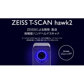
Portable and lightweight measurement device for development and manufacturing industries - 3D laser scanner.

A ZEISS 3D scanner that excels in precision and mobility. It achieves high-resolution visualization anywhere, from fine parts to large structures.

The "T-SCAN hawk 2" is a next-generation handheld 3D laser scanner that combines overwhelming high precision and mobility. By adopting a short-wavelength blue laser, it can easily scan glossy surfaces and black objects, which were previously difficult to scan. Additionally, it features the industry's first "Satellite Mode," allowing for easy measurement of large objects up to 4 meters in size without compromising accuracy. With an industry-leading precision of 0.02mm + 0.015mm/m and a high resolution of 0.05mm, it reliably reproduces fine details. The operability has been thoroughly pursued. The four buttons on the sensor body allow for the completion of the measurement workflow, eliminating the need to interrupt work for PC operations. With a lightweight design of under 1kg and an ultra-lightweight 10m cable, it enables stress-free scanning in various settings, from manufacturing sites to outdoors. It expands measurement possibilities across a wide range of applications, including CAD comparison and dimensional inspection in quality control, reverse engineering, and wear monitoring during maintenance. This all-in-one solution powerfully supports all manufacturing environments with just one device.

  • Other CAD related software
  • 3D measuring device
  • Other CAD
  • Laser scanner

Added to bookmarks

Bookmarks list

Bookmark has been removed

Bookmarks list

You can't add any more bookmarks

By registering as a member, you can increase the number of bookmarks you can save and organize them with labels.

Free membership registration

Laser Scanner J LZR-J

A compact laser sensor that detects in three dimensions with a 4-column laser curtain. It can be easily adjusted and set up with a dedicated remote control.

■Wide Detection Area The maximum detection distance is 9.9m x 9.9m. Distances can be specified in 10cm increments both vertically and horizontally. ■Three-Dimensional Detection Area (4-Column Laser Curtain) It has a curtain-like detection area with 4 columns (C1 to C4), enhancing detection capability. Depending on the installation location, you can choose to detect with 3 columns, 2 columns, etc., as desired. ■Automatic Setup Function It recognizes objects (such as floors, walls, and structures) within the detection area and can limit the detection area to only the space visible from the sensor. You can set a non-detection zone between 5cm and 25cm in 5cm increments from the object to reduce false triggers. ■Supports Horizontal and Vertical Installation It can be installed horizontally or vertically, and can be mounted at angles of -45°, 0°, or 45° on either the right or left side. It is suitable for vertical detection at openings or walls, as well as horizontal detection near the floor or ceiling. ■Easy Setup with Remote Control The settings for this device are made using an adjustment remote control (RC-240). You can confirm the settings through remote control operations and the indicator light on the sensor body.

  • Entrance and exit control system
  • Laser scanner

Added to bookmarks

Bookmarks list

Bookmark has been removed

Bookmarks list

You can't add any more bookmarks

By registering as a member, you can increase the number of bookmarks you can save and organize them with labels.

Free membership registration

UAV 3D (three-dimensional) laser measurement (ICT) service

Please leave the 3D i-con construction support services to us.

Our ICT team is engaged in i-con construction support services using 3D technology, from measurement to the creation of design data for ICT construction machinery and as-built measurements. We offer services such as "UAV-mounted green laser measurement," which uses a laser scanner (green light) mounted on a UAV to measure underwater surfaces that cannot be captured by laser scanners (red light) or photographs, and "ground-based laser scanners," which can safely and quickly create 3D models of extensive terrains containing water. 【Service Details】 ■ UAV-mounted green laser measurement ■ Ground-based laser scanner (3D measurement) ■ UAV surveying (photogrammetry) *For more details, please download the PDF or feel free to contact us. SGS Co., Ltd. 8-1 Higashiyama-cho, Yonago City, Tottori Prefecture (0859) 32-3308

  • Other measurement, recording and measuring instruments
  • Other environmental analysis equipment
  • Laser scanner

Added to bookmarks

Bookmarks list

Bookmark has been removed

Bookmarks list

You can't add any more bookmarks

By registering as a member, you can increase the number of bookmarks you can save and organize them with labels.

Free membership registration

Are you able to utilize point cloud data? [Plant measurement services and case studies available]

High-performance 3D scanner in use! After acquiring point cloud data, we provide one-stop services for 3D model creation, construction drawings, fabrication drawings, manufacturing of steel structures, and renovations!

Our company utilizes 3D laser measurement and 3D CAD modeling technology to provide a one-stop service from understanding the current situation to acquiring and extracting point cloud data, producing 3D models, creating drawings, and manufacturing and renovating steel structures. We use 3D laser scanners such as the "FARO FOCUS s150 Laser Scanner" and "Leica RTC360," as well as point cloud processing software "Infi Points," enabling highly accurate measurement and modeling. Please feel free to contact us if you have any requests. 【Service Details】 ■ Plant 3D measurement ■ Drawing of various plans and manufacturing drawings ■ Creation of 2D drawings from various structures in 3D ■ Manufacturing of steel structures ■ Renovation work, etc. Okayama Prefecture, Kurashiki City, Mizushima Okayama Prefecture 3D Scanner *For more details, please download the PDF or feel free to contact us.

  • Contract measurement
  • Laser scanner

Added to bookmarks

Bookmarks list

Bookmark has been removed

Bookmarks list

You can't add any more bookmarks

By registering as a member, you can increase the number of bookmarks you can save and organize them with labels.

Free membership registration

Laser Scanner and Point Cloud Utilization Case: Shooting Renovation Work

From creating drawings to the unfolding of sheet metal for manufacturing! It can be used in the process of measuring complex shapes on-site.

We utilized "laser scanners and point clouds" for the shoot renovation work. We can handle everything from creating drawings to developing sheet metal layouts. By measuring from both ground and aerial perspectives, we can achieve seamless measurements. This can be used as a substitute for measuring tools like tape measures, and during the process of measuring complex shapes on-site. Please feel free to contact us when needed. 【Features】 ■ Seamless measurements by measuring from both ground and aerial perspectives ■ Measurements can be taken in high locations, hazardous areas, and dark places ■ Backpack type ■ Time-saving and cost-reducing ■ Easily grasp the overall picture at about 1/4 the cost of fixed scanners *For more details, please refer to the PDF document or feel free to contact us.

  • Distance measuring device
  • Laser scanner

Added to bookmarks

Bookmarks list

Bookmark has been removed

Bookmarks list

You can't add any more bookmarks

By registering as a member, you can increase the number of bookmarks you can save and organize them with labels.

Free membership registration

3D Laser Scanner 【Trimble SX12】

New genre of surveying equipment for measurement and civil engineering/i-Construction: scanning total station.

The Trimble SX12 has successfully expanded its role in public surveying by integrating a total station and a ground-based laser scanner, significantly broadening the use of point clouds. Furthermore, by adding new features, it enhances convenience and is expected to expand the scope of work for scanning total stations. The Trimble SX12 demonstrates its power in various fields such as civil engineering, construction, and surveying. The Trimble SX12 is a new genre of surveying instrument. It is a surveying device that perfectly combines a high-precision, high-performance servo total station with a long-range 3D laser scanner and a high-resolution imager. With this single unit, not only will you improve work efficiency, but it will also expand the possibilities of your surveying operations to infinity.

  • 3D measuring device
  • others
  • Laser scanner

Added to bookmarks

Bookmarks list

Bookmark has been removed

Bookmarks list

You can't add any more bookmarks

By registering as a member, you can increase the number of bookmarks you can save and organize them with labels.

Free membership registration

[Discontinued] 3D Laser Scanner Trimble TX8/TX6

[Sold Out] i-Construction, surveying, construction, building equipment, structural measurement, plant. 3D laser scanner providing the highest quality in the world.

[Discontinued] The Trimble TX8 is a laser scanner capable of managing the shapes of facilities and equipment that require high-density measurements, as well as understanding the current state of plants and factory equipment. It can be used in various applications such as as-built measurements, current condition surveys, and structural measurements. With the latest distance measurement technology, Trimble Lightning Technology, it offers ultra-fast scanning at a rate of up to 1 million points per second, a wide measurement range of up to 340 meters, and a very high precision with point cloud distance noise of just 2mm. It is a laser scanner that combines "speed," "density," and "accuracy."

  • others
  • Laser scanner

Added to bookmarks

Bookmarks list

Bookmark has been removed

Bookmarks list

You can't add any more bookmarks

By registering as a member, you can increase the number of bookmarks you can save and organize them with labels.

Free membership registration

3D Laser Scanner Trimble X9 FieldLink

A next-generation 3D laser scanner that breaks the common sense for architecture, equipment, and BIM.

The Trimble X9 (for construction and facilities) is a site-based 3D laser scanner that quickly captures point clouds at construction sites and maintenance locations for structures and facilities, allowing for consistency checks with data created in BIM. ■ Its lightweight and compact design, along with a lightweight and robust carbon tripod, makes it easy to take to the site. ■ Setting up for point cloud measurement is simple, enabling even beginners to easily acquire and synthesize point clouds on-site. The synthesized point cloud data can be compared with various 2D/3D design data on a dedicated controller, allowing for on-site completion of progress management and quality verification. ■ When bringing the device to the site for observation, it can measure point clouds in accordance with pre-prepared design data, and even from a blank state, point clouds can be synthesized simply by observing from multiple arbitrary points, with data output available on-site. We provide various automatic functions to ensure that even those without specialized surveying knowledge can acquire high-quality point cloud data.

  • others
  • Laser scanner

Added to bookmarks

Bookmarks list

Bookmark has been removed

Bookmarks list

You can't add any more bookmarks

By registering as a member, you can increase the number of bookmarks you can save and organize them with labels.

Free membership registration

Report on Laser Scan Results and Use Cases with Hovermap STX

An efficient data acquisition method utilizing advanced technology! Also introducing future directions.

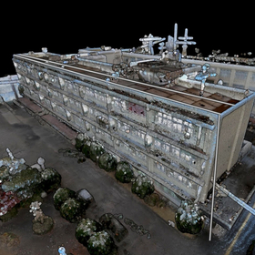
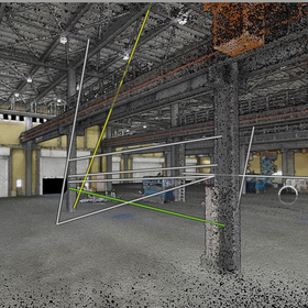
This document includes a report on the results of laser scanning within the factory using Hovermap STX and examples of its application. We introduce the "technical features and reasons for the introduction of Hovermap STX," highlighting the use of SLAM technology, high-precision 3D mapping, shortened construction periods, and improved safety. Additionally, at the end of the document, we also cover the effects of introducing Hovermap STX, as well as the benefits of management and renovation. Please take a look. [Contents] ■ Overview of Hovermap STX and its application in factory scanning ■ Introduction of laser scanning results within the factory ■ Utilization of scan data and future prospects ■ Summary and future direction *For more details, please download the PDF or feel free to contact us.

  • unnamed (1).jpg
  • シーズ様.jpg
  • シーズ様.jpg
  • シーズ様2.png
  • Scanner
  • Other measurement, recording and measuring instruments
  • Laser scanner

Added to bookmarks

Bookmarks list

Bookmark has been removed

Bookmarks list

You can't add any more bookmarks

By registering as a member, you can increase the number of bookmarks you can save and organize them with labels.

Free membership registration

Sees Project Inc. Company Information

A specialized team that supports you in obtaining high-precision spatial data and utilizing it for your business!

Seez Project Co., Ltd. is a company that supports the resolution of various challenges, including optimization of facility layouts, equipment placement, warehouse space management, infrastructure inspection and maintenance, and improvement of operational efficiency through digital twins. By combining precise spatial data cultivated through years of drone aerial photography and laser scanning/3D measurement with expertise in visual storytelling, we provide suitable information for recording, investigation, and consideration in these fields. Please feel free to contact us when you need our services. 【Business Activities】 ■ Aerial Photography Services ■ Laser Scanning ■ Point Cloud Processing ■ Scan-to-BIM/CAD ■ Layout Planning ■ Digital Twin Construction ■ Application Development Proposals *For more details, please download the PDF or feel free to contact us.

  • Other factory equipment
  • 3D CAD
  • Laser scanner

Added to bookmarks

Bookmarks list

Bookmark has been removed

Bookmarks list

You can't add any more bookmarks

By registering as a member, you can increase the number of bookmarks you can save and organize them with labels.

Free membership registration

Laser Data Trace Software "BSTrace"

Software that performs various processes without filtering laser data!

"BSTrace" is a laser data tracing software that can perform tasks such as "tracing work," "longitudinal and cross-sectional work," and "frame data analysis." It is possible to recognize the outer shape of a building through slice cross-section processing. Linear data can be registered, and after calculating measurement points including plus stakes, longitudinal and cross-sectional data can be recognized. Additionally, while it is not fully automatic, it has a simple filtering function. 【Features】 ■ Basically displays in three screens: "2D display," "3D display," and "cross-section display" ■ Allows for location identification while checking the wires connected to utility poles ■ Capable of creating longitudinal and cross-sectional diagrams ■ Can analyze frame data ■ Recognized CAD data is saved as 3D CAD data *For more details, please refer to the PDF document or feel free to contact us.

  • 3D measuring device
  • Laser scanner

Added to bookmarks

Bookmarks list

Bookmark has been removed

Bookmarks list

You can't add any more bookmarks

By registering as a member, you can increase the number of bookmarks you can save and organize them with labels.

Free membership registration

Basin Analysis System "D-Bas"

Automatic access to the National Land Geographic Institute tiles! Automatically create triangular mesh surfaces.

"D-Bas" is a watershed analysis system that can automatically create triangular mesh surfaces by reading mesh data from the Geospatial Information Authority of Japan. It can also generate contour lines and recognize specified locations. If you have an internet connection, you can download tile data from the Geospatial Information Authority's website and display it on our software. If you do not have a connection, it is also possible to download it in advance. 【Features】 ■ Automatic creation of contour line data ■ Automatic access to Geospatial Information Authority tiles ■ Export to PDF (3D) ■ Export to CAD data ■ Confirmation of flow cross-sections ■ Display of arbitrary cross-sections *For more details, please refer to the PDF materials or feel free to contact us.

  • 3D measuring device
  • Laser scanner

Added to bookmarks

Bookmarks list

Bookmark has been removed

Bookmarks list

You can't add any more bookmarks

By registering as a member, you can increase the number of bookmarks you can save and organize them with labels.

Free membership registration