
Workflow using on-site and computer! It determines accurate position and posture even in windy conditions.
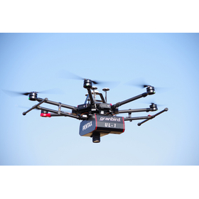
The "UL-1" is a UAV and laser surveying system capable of high-precision three-dimensional modeling of numerical terrain models and large-scale numerical topographic maps. Laser surveying and aerial photogrammetry are complemented by synchronization/hybridization through IMU. Aerial photogrammetry for map creation is easily realized with UAVs. It demonstrates cost performance in mapping areas that include urban and forested regions. It is equipped with a long-range scanner and a full-size sensor DSLR camera. 【Features】 ■ High-rate GNSS/IMU sensors ensure precise position and orientation ■ Scanning width of 300m from a ground height of 150m ■ Workflow between the field and computer ■ Significant reduction in the number of GCPs ■ Built-in DSLR camera with a full-size sensor *For more details, please refer to the catalog or PDF materials, or feel free to contact us. ★ This product is a surveying instrument that can utilize "subsidy support" upon purchase. It may be available for purchase at 1/2 to 1/3 of the regular price! If you are interested, please do not hesitate to contact us.
Inquire About This Product
basic information
【Main Unit Specifications】 ■ Size: Approximately 26.6mm × 30.8cm × 23.5cm (main unit) ■ Size: Approximately 26.6cm × 33.0cm × 36.0cm (including antenna) ■ Weight: Approximately 4.8kg (including scanner/camera/battery) ■ Operating temperature range: 0℃ to 40℃ ■ Power supply: TB47S battery (4500mAh) ■ Continuous operating time: Up to approximately 4.5 hours ■ Communication method: Wireless connection (Wi-Fi) *For more details, please refer to the catalog or PDF materials, or feel free to contact us.
Price range
Delivery Time
Applications/Examples of results
For more details, please refer to the PDF document or feel free to contact us.
catalog(8)
Download All Catalogs![UAV Laser Surveying System UL-1 [Discontinued]](https://image.mono.ipros.com/public/catalog/image/01/a34/507039/IPROS31283546511752388759.jpeg?w=120&h=170)


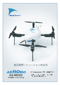
![Photogrammetry and Control Point Survey Analysis Cloud [AeroBo Cloud]](https://image.mono.ipros.com/public/catalog/image/01/d6c/741449/IPROS98596987516529078773.jpeg?w=120&h=170)
Company information
Yokohama Measuring Instruments Co., Ltd. is engaged in the sale, repair, maintenance, and rental of surveying instruments (general surveying instruments, GNSS, laser scanners, etc.), surveying CAD software, multifunction office equipment, and other related products. We offer a lineup of products from various manufacturers, including Leica, Topcon Sokkia, and Pentax. Please feel free to contact us if you have any requests. We have established a new consulting division to support subsidy applications. We provide support for two types of subsidy applications: "Monozukuri Subsidy" and "Business Restructuring Subsidy." Our company will comprehensively support the necessary business plans and application procedures required for the application process. If you have any other questions, please do not hesitate to let us know.
![[Subsidy-eligible product] UAV and laser surveying system 'UL-2'](https://image.mono.ipros.com/public/product/image/fdc/2001109052/IPROS81370404845179255633.jpeg?w=280&h=280)
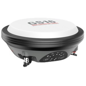
![[Subsidy-eligible product] UAV and laser surveying system 'UL-3'](https://image.mono.ipros.com/public/product/image/94e/2001466191/IPROS40664949954428464270.jpeg?w=280&h=280)

![[PENTAX UAV Laser Surveying System]](https://image.mono.ipros.com/public/product/image/030/2000681148/IPROS57429107735906291800.png?w=280&h=280)
![[Example] UAV Laser Surveying i-construction Initial Survey](https://image.mono.ipros.com/public/product/image/907/2000681275/IPROS59892963063401080916.png?w=280&h=280)
![Efficient output of accurate 3D point clouds and photos [Vehicle-mounted photo laser measurement]](https://image.mono.ipros.com/public/product/image/2e0/2000499811/IPROS42892914101251661396.jpeg?w=280&h=280)