1~45 item / All 61 items
Displayed results

Added to bookmarks
Bookmarks listBookmark has been removed
Bookmarks listYou can't add any more bookmarks
By registering as a member, you can increase the number of bookmarks you can save and organize them with labels.
Free membership registration
Contact this company
Inquiry Form1~45 item / All 61 items
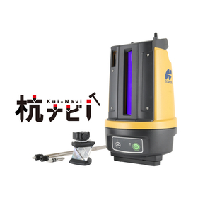
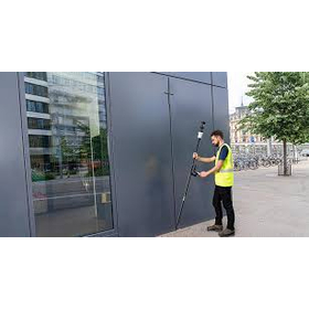
The "LN-160 Pile Navigator" is a pile navigation tool that allows for safe long-duration work, even when used for a full day! 【Features】 ■ Equipped with an external power port, enabling safe long-duration work! ■ Achieves labor-saving with a 120% increase in usage time compared to conventional models! ■ Maximum elevation angle of +55° and maximum depression angle of -32°, expanding the angle measurement area! Measurement range is a diameter of 260m! ■ Easy installation with automatic leveling. *For more details, please refer to the catalog or PDF materials, or feel free to contact us. ★ This product is a surveying instrument eligible for "subsidy utilization" upon purchase. It may be available for purchase at 1/2 to 1/3 of the regular price! If you are interested, please do not hesitate to contact us.
Added to bookmarks
Bookmarks listBookmark has been removed
Bookmarks listYou can't add any more bookmarks
By registering as a member, you can increase the number of bookmarks you can save and organize them with labels.
Free membership registration
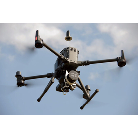
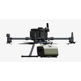
The "UL-3" is a UAV and laser surveying system capable of high-precision three-dimensional modeling of numerical terrain models and large-scale numerical topographic maps. 【Features】 ■ LiDAR sensor with a point cloud density of 640,000 points/360° ■ Maximum measurement distance of 300 meters, suitable for measuring forest areas and disaster sites ■ Equipped with high-rate GNSS/IMU sensors and the Matrice 350 airframe ■ Maximum flight time of 30 minutes (during hovering) with a communication range of approximately 8 km ■ The area that can be measured on a single full charge is 458m x 458m = approximately 21 hectares (equivalent to about 4.5 Tokyo Domes). ■ The intuitive software "LP360" allows for the generation of deliverables and classification of point clouds. *For more details, please refer to the catalog or PDF materials, or feel free to contact us. ★ This product is a surveying instrument that can utilize "subsidy funding" upon purchase. It may be possible to purchase at a price of 1/2 to 1/3 of the regular price! If you are interested, please do not hesitate to contact us.
Added to bookmarks
Bookmarks listBookmark has been removed
Bookmarks listYou can't add any more bookmarks
By registering as a member, you can increase the number of bookmarks you can save and organize them with labels.
Free membership registration
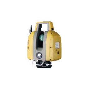
【Features】 ■ Easy leveling with a single button ■ Automatic target detection ■ Immediate verification of measurement data on-site using 'Topcon Raster Scan' (field software for bullets) to ensure reliable acquisition ■ Automatic merging of scan data ■ Data output after analysis is also possible *For more details, please refer to the PDF document or feel free to contact us.
Added to bookmarks
Bookmarks listBookmark has been removed
Bookmarks listYou can't add any more bookmarks
By registering as a member, you can increase the number of bookmarks you can save and organize them with labels.
Free membership registration
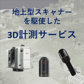
We can acquire 3D point cloud data using our terrestrial and handheld laser scanners. Additionally, we offer GNSS surveying services and can accommodate requests for RTK surveying and static surveying as needed! 【Features of 3D Measurement Services】 - Smooth response from initial meetings to the field - Delivery of 3D point cloud data in the requested data format - Data delivery within as little as 2 business days (delivery time may vary depending on the size of the site). We have a proven track record in various scenes such as roads and fields. Please feel free to consult with us!
Added to bookmarks
Bookmarks listBookmark has been removed
Bookmarks listYou can't add any more bookmarks
By registering as a member, you can increase the number of bookmarks you can save and organize them with labels.
Free membership registration
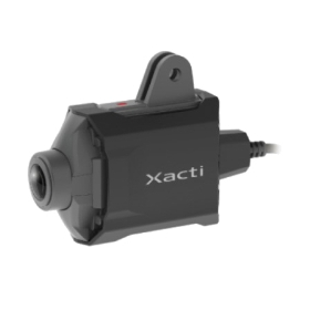
【Features】 Point 1: Unique shake correction function! Point 2: Waterproof and dustproof structure, usable in environments up to 50°C Point 3: Compatible with iOS/Android/Windows Point 4: Supports Microsoft Teams and ZOOM It solves challenges such as "DX and work style reform," "labor shortages," and "technology inheritance"! *For more details, please refer to the catalog or PDF materials, or feel free to contact us.
Added to bookmarks
Bookmarks listBookmark has been removed
Bookmarks listYou can't add any more bookmarks
By registering as a member, you can increase the number of bookmarks you can save and organize them with labels.
Free membership registration
【Features】 Point 1: Measurement possible at wall edges! Point 2: Reduced number of instrument setups! Point 3: No need to input pole height! Significantly increases current surveying speed without the need for two legs! *For more details, please refer to the catalog or PDF materials, or feel free to contact us.
Added to bookmarks
Bookmarks listBookmark has been removed
Bookmarks listYou can't add any more bookmarks
By registering as a member, you can increase the number of bookmarks you can save and organize them with labels.
Free membership registration
In the new era of measurement digitalization, we are linking groundbreaking observation instruments with smart technology to support observation, editing, and results. The system will be updated and released as the latest version! Scheduled start date for sales: March 19, 2024 (Tuesday) Standard price: 1,155,000 yen (including tax) and up
Added to bookmarks
Bookmarks listBookmark has been removed
Bookmarks listYou can't add any more bookmarks
By registering as a member, you can increase the number of bookmarks you can save and organize them with labels.
Free membership registration
The "Leica BLK2FLY" can perform 3D scanning in hard-to-access places such as ceilings and roofs, both indoors and outdoors. It captures the exterior of buildings, structures, and environments, creating 3D point clouds while in flight. It can be activated with just a few taps on a tablet, allowing for aerial scanning of structures and environments. Aerial scanning is beneficial for cases that require accurate data from hard-to-reach or inaccessible locations, as it can fully capture the features and dimensions of a structure's exterior. 【Features】 - One-button operation - No calibration required for flight - Safe and stress-free flight enabled by obstacle detection - Easy creation of automatic flight plans from the operating application
Added to bookmarks
Bookmarks listBookmark has been removed
Bookmarks listYou can't add any more bookmarks
By registering as a member, you can increase the number of bookmarks you can save and organize them with labels.
Free membership registration
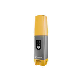
【Features】 ■ Compatible with all satellites ■ Ultra-compact and robust body ■ Easy and simple interface ■ Compatible with hybrid survey systems ■ LongLink data communication ■ Built-in battery with 10 hours of operation *For more details, please refer to the PDF document or feel free to contact us.
Added to bookmarks
Bookmarks listBookmark has been removed
Bookmarks listYou can't add any more bookmarks
By registering as a member, you can increase the number of bookmarks you can save and organize them with labels.
Free membership registration
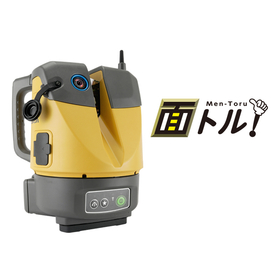
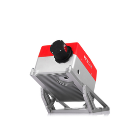
Mobile 2D scanner suitable for high-speed distance measurement Acquires color point clouds with 4 built-in cameras (S-2200C) Equipped with 4 calibrated cameras. The cameras and scanner are precisely matched, eliminating the need for calibration during use. Point cloud data is accurately colorized.
Added to bookmarks
Bookmarks listBookmark has been removed
Bookmarks listYou can't add any more bookmarks
By registering as a member, you can increase the number of bookmarks you can save and organize them with labels.
Free membership registration
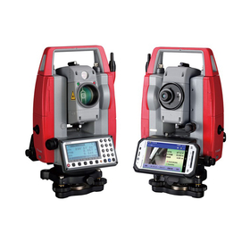
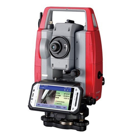
Camera function + Android device Total station with dual features! 【Features】 ■ Smooth data sharing with Android device ■ Strong support for measurement and construction work with various functions ■ Convenient linkage of measurement points and photos for electronic delivery *For more details, please refer to the PDF document or feel free to contact us.
Added to bookmarks
Bookmarks listBookmark has been removed
Bookmarks listYou can't add any more bookmarks
By registering as a member, you can increase the number of bookmarks you can save and organize them with labels.
Free membership registration
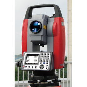
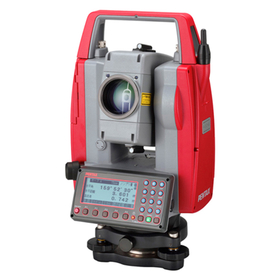
Non-prism 600m high-speed and stable distance/angle setting Non-prism approximately 0.3 seconds accuracy 3+3ppm Prism approximately 0.8 seconds accuracy 2+2ppm 【Features】 ■ Equipped with electronic bubble level/laser centering/new line measurement function ■ Maximum range for non-prism: 600m ■ Non-prism approximately 0.3 seconds accuracy 3+3ppm ■ Prism approximately 0.8 seconds accuracy 2+2ppm *For more details, please refer to the PDF document or feel free to contact us.
Added to bookmarks
Bookmarks listBookmark has been removed
Bookmarks listYou can't add any more bookmarks
By registering as a member, you can increase the number of bookmarks you can save and organize them with labels.
Free membership registration
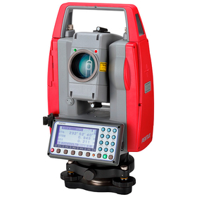
Equipped with a new EDM mechanism, the distance measurement performance has evolved. 【Features】 ■ Non-prism (NSC model) range: 500m ■ Measurement time: Non-prism approximately 1.0 seconds※4 ■ Application function includes a route calculation program ※ For more details, please refer to the PDF document or feel free to contact us.
Added to bookmarks
Bookmarks listBookmark has been removed
Bookmarks listYou can't add any more bookmarks
By registering as a member, you can increase the number of bookmarks you can save and organize them with labels.
Free membership registration
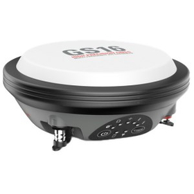
The GS16, which has high reliability, is a product for surveyors who need a GNSS surveying system that adapts to surveying sites. It is lightweight, making it portable anywhere, and can measure even in harsh and difficult field environments. *For more details, please refer to the catalog or PDF materials, or feel free to contact us.*
Added to bookmarks
Bookmarks listBookmark has been removed
Bookmarks listYou can't add any more bookmarks
By registering as a member, you can increase the number of bookmarks you can save and organize them with labels.
Free membership registration
【Features】 ■Easy and simple measurement by one person ■Robust body strong enough for harsh environments ■LongLink data communication ■Excellent environmental performance IP67 ■Achieves over 15 hours of continuous use ■Compatible with the Quasi-Zenith Satellite System *For more details, please refer to the PDF document or feel free to contact us.
Added to bookmarks
Bookmarks listBookmark has been removed
Bookmarks listYou can't add any more bookmarks
By registering as a member, you can increase the number of bookmarks you can save and organize them with labels.
Free membership registration
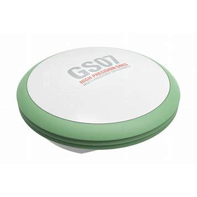
The GS07 is a lightweight yet robust device that offers the essential functions users need while also embodying the highest level of quality found in Leica Geosystems' GNSS products. It is an easy-to-use rover equipped with 320 channels, multi-frequency, and multi-GNSS capabilities, ensuring quick and reliable staking and data capture. It also supports functionality expansion through communication terminals such as UHF radios fully integrated with the CS20. The connection with Leica Captivate field software and the Leica CS20 field controller allows the GS07 to deliver high-quality features. *For more details, please refer to the catalog or PDF materials, or feel free to contact us.*
Added to bookmarks
Bookmarks listBookmark has been removed
Bookmarks listYou can't add any more bookmarks
By registering as a member, you can increase the number of bookmarks you can save and organize them with labels.
Free membership registration
Equipped with numerous features that enhance work efficiency, such as automatic image tracing and automatic point cloud tracing functions. It is suitable for tasks involving point clouds and 3D data in surveying, civil engineering design, construction, dredging, and consulting. 【Features】 ■ Automatically classifies point clouds into ground and non-ground, allowing for color coding, visibility toggling, and deletion of each ■ Reads edges and lines from images and automatically draws FDG lines ■ Automatically traces edges and lines of point clouds, enabling quick conversion of 3D data into 3D models or cross-sectional views ■ Easy color switching for point clouds and TIN, as well as coloring by height or value ■ Capable of creating surfaces with Z values in 2D and simple 3D structures *For more details, please refer to the PDF document. ★ This product is a surveying instrument that can utilize "subsidy funding" at the time of purchase. It may be possible to purchase at a price of 1/2 to 1/3 of the regular price! If you are interested, please feel free to contact us.
Added to bookmarks
Bookmarks listBookmark has been removed
Bookmarks listYou can't add any more bookmarks
By registering as a member, you can increase the number of bookmarks you can save and organize them with labels.
Free membership registration
The "UL-2" is a UAV and laser surveying system capable of high-precision three-dimensional modeling of numerical terrain models and large-scale numerical topographic maps. 【Features】 ■ Total weight: lightweight and compact at 9kg (including measurement unit approximately 2.7kg) ■ Flight time: approximately 27 minutes (during hovering) ■ Multi-echo compatible high-precision laser equipped ■ High-rate GNSS/IMU equipped: calculates position and orientation with high precision ■ Camera: 12.3 million pixels ■ Airframe: DJI Matrice 300 ■ Controller with operation panel (no tablet required) ■ Communication range: approximately 8km (domestic) ■ Equipped with six-direction obstacle sensors. The folding structure allows for easy assembly when stored. The main battery consists of two units that can be hot-swapped. *For more details, please refer to the catalog or PDF materials, or feel free to contact us. ★ This product is a surveying instrument that can utilize "subsidy support" at the time of purchase. It may be available for purchase at 1/2 to 1/3 of the regular price! If you are interested, please do not hesitate to contact us.
Added to bookmarks
Bookmarks listBookmark has been removed
Bookmarks listYou can't add any more bookmarks
By registering as a member, you can increase the number of bookmarks you can save and organize them with labels.
Free membership registration
The measurable range can be selected from three options: 250m, 750m, and 2000m. Depending on the settings, the data collection rate can also be switched. Options such as external cameras and external GPS can be added. 【Features】 ■ Maximum measurement distance of 2000m ■ Capable of measuring a wide area in a short time ■ Allows for safe short-term measurements from a distance in hard-to-access locations ■ Capable of measuring a wide area in one scan even on the ground surface ■ Reduces the number of scanner installation points, thus shortening the construction period ■ Does not require much time to learn the operation method ■ A long-range scanner suitable for efforts towards i-Construction *For more details, please refer to the PDF document or feel free to contact us.
Added to bookmarks
Bookmarks listBookmark has been removed
Bookmarks listYou can't add any more bookmarks
By registering as a member, you can increase the number of bookmarks you can save and organize them with labels.
Free membership registration
【Features】 ■ Total station surveying and laser scanning measurements can be performed with one device ■ Point cloud density is twice that of conventional machines ■ Ideal for construction management using BIM ■ Highly effective for civil engineering, surveying, and maintenance management ■ Equipped with the onboard program MAGNET Field ■ Includes a Wi-Fi module ■ Remote operation via Collage Site is also possible *For more details, please refer to the PDF document or feel free to contact us.
Added to bookmarks
Bookmarks listBookmark has been removed
Bookmarks listYou can't add any more bookmarks
By registering as a member, you can increase the number of bookmarks you can save and organize them with labels.
Free membership registration
【Features】 ■ Class-leading speed! New control ultrasonic motor direct drive ■ Class-leading compactness! Ultra-compact body boasting high mobility ■ Class-leading lightweight! Achieving 5.7kg with motor drive TS ■ Best-in-class top-con quality ■ Expanding applications to UAV surveying, ICT construction control, and hybrid survey systems! * For more details, please refer to the PDF materials or feel free to contact us.
Added to bookmarks
Bookmarks listBookmark has been removed
Bookmarks listYou can't add any more bookmarks
By registering as a member, you can increase the number of bookmarks you can save and organize them with labels.
Free membership registration
The "LN-150 Pile Navigator" is a layout navigator that allows anyone to easily and quickly drive piles by themselves. 【Features】 - Effective even in sites with elevation differences - Easy setup with automatic leveling - Simple operation with smartphones and tablets - Ultra-fast response for pile driving (marking) - Compatible with a variety of site applications *For more details, please refer to the PDF materials or feel free to contact us.
Added to bookmarks
Bookmarks listBookmark has been removed
Bookmarks listYou can't add any more bookmarks
By registering as a member, you can increase the number of bookmarks you can save and organize them with labels.
Free membership registration
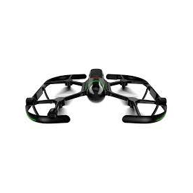
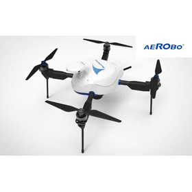
The "AeroBo (AS-MC03)" is a drone suitable for surveying and inspection using photographs taken from the sky. It is equipped with a high-performance camera that can achieve high image quality even with a fast shutter speed, as well as a high-sensitivity image sensor. Additionally, it features a mechanical shutter mechanism that minimizes image distortion, enabling high-precision and reliable drone surveying. 【Features of AeroBo (AS-MC03)】 ■ High-performance camera with an APS-C size image sensor and interchangeable lenses, ideal for surveying ■ Automation of camera and route settings compliant with I-Construction standards ■ Robust for on-site operations, with waterproof, dustproof, and wind-resistant capabilities *For more details, please refer to the PDF document or feel free to contact us.
Added to bookmarks
Bookmarks listBookmark has been removed
Bookmarks listYou can't add any more bookmarks
By registering as a member, you can increase the number of bookmarks you can save and organize them with labels.
Free membership registration
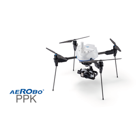
The "AeroRob PPK" is a domestically developed drone specifically designed for photogrammetry, created to reduce the labor involved in installing ground control points during the photogrammetry process. It allows for photogrammetry to be conducted without the need to set up reference points, making it particularly recommended for daily applications such as "site progress management" and "volume inventory." 【Features of the New AeroRob PPK】 ■ Ease of use ■ Capable of surveying in hard-to-reach areas ■ Covers 10 hectares in one flight ■ Operates safely with fully automated flights *For more details, please refer to the PDF document or feel free to contact us.
Added to bookmarks
Bookmarks listBookmark has been removed
Bookmarks listYou can't add any more bookmarks
By registering as a member, you can increase the number of bookmarks you can save and organize them with labels.
Free membership registration
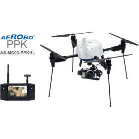
The "New AeroBot PPK" achieves long-distance communication performance by adopting Herelink HD Transmission. It allows for "checking the camera footage during flight" and "taking completion photos from any angle by operating the gimbal" on the control terminal, significantly enhancing convenience. 【Features of the New AeroBot PPK】 ■ Equipped with a dual-frequency GNSS receiver ■ Adopts Herelink HD Transmission ■ Features quick attachment *For more details, please refer to the PDF document or feel free to contact us.
Added to bookmarks
Bookmarks listBookmark has been removed
Bookmarks listYou can't add any more bookmarks
By registering as a member, you can increase the number of bookmarks you can save and organize them with labels.
Free membership registration
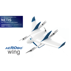
"Aerobowing" is capable of high-speed flight with a maximum range of 50 km and a top speed of 100 km/h. It is utilized in areas where long-distance and wide-ranging flights are necessary, such as inspections in mountainous regions, patrols over maritime areas, and survey flights along rivers. 【Features of Aerobowing】 ■ Capable of flying a straight distance of 50 km and surveying an area of 300 ha in one flight ■ Fully automated flight from takeoff to landing ■ Utilizes LTE communication for flights beyond the wireless reach ■ Can take off and land from limited spaces *For more details, please refer to the PDF document or feel free to contact us.
Added to bookmarks
Bookmarks listBookmark has been removed
Bookmarks listYou can't add any more bookmarks
By registering as a member, you can increase the number of bookmarks you can save and organize them with labels.
Free membership registration
REGISTER 360 is easy to use for users of any technical level, accurately measures results, visualizes them in greater detail, and allows for more effective sharing and utilization within teams, placing the user at the center of the project. Whether used as a standalone solution or as part of a comprehensive integrated digital reality capture solution, Cyclone REGISTER 360 is the first product that enables you to complete your work the fastest, easiest, and most accurately.
Added to bookmarks
Bookmarks listBookmark has been removed
Bookmarks listYou can't add any more bookmarks
By registering as a member, you can increase the number of bookmarks you can save and organize them with labels.
Free membership registration
【Features】 Point 1: Equipped with instrument point and rear sight method/rear intersection method program Point 2: Long-distance target scanning compatible with 360° prisms Point 3: Surface accuracy improved to 1mm (σ) Easy and high-precision instrument point and rear sight method/rear intersection method program included *For more details, please refer to the catalog or PDF materials, or feel free to contact us. ★This product is a surveying instrument eligible for "subsidy utilization" upon purchase. It may be possible to purchase at a price of 1/2 to 1/3 of the regular price! If you are interested, please do not hesitate to contact us.
Added to bookmarks
Bookmarks listBookmark has been removed
Bookmarks listYou can't add any more bookmarks
By registering as a member, you can increase the number of bookmarks you can save and organize them with labels.
Free membership registration
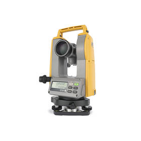
【Features】 ■ Long continuous use that makes you forget when you last replaced the battery Can be used for 1 month* with daily use! With the optional lithium-ion battery, even longer usage time ■ Laser pointer with focus function for pinpoint targeting ■ Higher quality using common parts with total stations ■ Equipped with a tilt sensor on 5”/7” models ■ Environmental performance that withstands dust and heavy rain *For more details, please refer to the PDF document or feel free to contact us.
Added to bookmarks
Bookmarks listBookmark has been removed
Bookmarks listYou can't add any more bookmarks
By registering as a member, you can increase the number of bookmarks you can save and organize them with labels.
Free membership registration
The "R-500 Series" is equipped with a newly designed EDM mechanism that has improved the optical system, significantly enhancing measurement time and accuracy. It includes a wealth of application features such as reciprocal observation, reverse measurement, and internal and external point division! 【Features】 ■ Non-prism measurement up to 600m ■ Easy-to-read electronic bubble level in a rod shape ■ Quick laser setup for easy installation ■ Convenient application software ■ Dustproof and waterproof IP56 *For more details, please refer to the PDF document or feel free to contact us.
Added to bookmarks
Bookmarks listBookmark has been removed
Bookmarks listYou can't add any more bookmarks
By registering as a member, you can increase the number of bookmarks you can save and organize them with labels.
Free membership registration
The "V-280 Series" is a total station that can simultaneously display horizontal angles, horizontal distances, and elevation differences in clear text on a large graphic screen. In addition to standard angle and distance measurements, it is equipped with convenient application functions that can adapt to various job sites. It is useful in various situations, from confirming traverse stakes before construction to reverse measurement and construction management surveying. 【Features】 ■ Non-prism distance measurement up to 300m ■ Large screen and easy-to-understand operation ■ Convenient distance measurement functions that can be differentiated by application ■ Handy application software ■ Dustproof and waterproof IP56 *For more details, please refer to the PDF materials or feel free to contact us.
Added to bookmarks
Bookmarks listBookmark has been removed
Bookmarks listYou can't add any more bookmarks
By registering as a member, you can increase the number of bookmarks you can save and organize them with labels.
Free membership registration
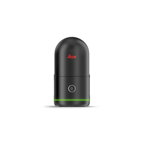
The BLK2GO performs millions of high-precision measurements simply by pressing a button to power it on and walking around, recreating the surrounding space in 3D. The data from the BLK2GO serves as the foundational data for accurate floor plans, BIM models, and 3D visualizations. With a scanning speed of up to 420,000 points per second, it can measure up to 25 meters away. 【Features】 ■ Lightweight, compact, and affordable 3D laser scanner ■ Easy operation with just a push of a button ■ Rechargeable battery allows for continuous scanning for 45 minutes ★ We provide comprehensive support for applying for manufacturing subsidies in collaboration with specialized consultants. Please feel free to contact us for more details. ★ Our company offers a variety of surveying equipment and systems, allowing us to make proposals tailored to your needs. Please refer to the basic information section for examples of products we handle.
Added to bookmarks
Bookmarks listBookmark has been removed
Bookmarks listYou can't add any more bookmarks
By registering as a member, you can increase the number of bookmarks you can save and organize them with labels.
Free membership registration
The "BLK360 G2" can perform a full scan, including spherical images, in just 20 seconds, which is over five times faster than the conventional BLK360, with just the push of a button. The data from the BLK360 G2 is useful for a wide range of applications, from traditional architecture and construction to innovative VFX (visual effects) and VR (virtual reality). With a scanning speed of up to 680,000 points per second, it can measure up to 45 meters. Additionally, the data from the BLK360 G2 is beneficial for many applications, from traditional architecture and construction to innovative VFX and VR. For more details, please refer to the product catalog. 【Features】 ■ Lightweight, compact, and affordable 3D laser scanner ■ Easy operation with just the push of a button ★ We provide comprehensive support for the application process for manufacturing subsidies in collaboration with specialized consultants. Please feel free to contact us for more details. ★ Our company offers a variety of surveying equipment and systems, and we can provide proposals tailored to your needs. Please refer to the basic information section for examples of our products.
Added to bookmarks
Bookmarks listBookmark has been removed
Bookmarks listYou can't add any more bookmarks
By registering as a member, you can increase the number of bookmarks you can save and organize them with labels.
Free membership registration
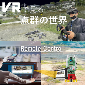
It has become possible to check and perform simple measurements of point cloud data obtained from a 3D laser scanner in VR. What we introduce is a method to utilize point cloud data obtained from a Leica laser scanner in VR. By importing the point cloud data obtained from the Leica laser scanner into analysis software and creating it as an LGS file, you can check the point cloud data and perform simple measurements by importing the LGS file into an application called trueviewVR. Additionally, our company provides comprehensive support from application assistance for manufacturing subsidies and business restructuring subsidies to the introduction of surveying equipment. We encourage you to consider capital investment using subsidies. We have supported approximately 80 companies, with an acceptance rate of over 80%. More than 30 businesses have received the maximum subsidy amount. The total amount of subsidies received by the businesses we supported exceeds 700 million yen. *Please view the materials from the "Download" section below. *We also conduct meetings and online meetings regarding subsidy application support, so please feel free to let us know if you are interested. *For any other inquiries, please do not hesitate to contact us.
Added to bookmarks
Bookmarks listBookmark has been removed
Bookmarks listYou can't add any more bookmarks
By registering as a member, you can increase the number of bookmarks you can save and organize them with labels.
Free membership registration
Point cloud data obtained from a 3D laser scanner can now be checked and measured easily in VR. (Available only for products from Leica and ZF.) Additionally, we are proposing technology that allows remote operation of total stations with automatic tracking! Our company provides comprehensive support from application assistance for manufacturing subsidies and business restructuring subsidies to the introduction of surveying equipment. We encourage you to consider capital investment utilizing subsidies. 【Achievements since 2019 (as of August 10, 2023)】 Manufacturing subsidy: Acceptance rate of 87% (54 out of 62 companies accepted) Business restructuring subsidy: Acceptance rate of 76% (13 out of 17 companies accepted) Approximately 30 companies have received the maximum subsidy amount. The total amount of subsidies received by the supported companies is about 700 million yen. *Please view the materials from the "Download" section below. *We also conduct meetings and online meetings regarding subsidy application support, so please feel free to let us know if you wish to do so. *For any other inquiries, please do not hesitate to contact us.
Added to bookmarks
Bookmarks listBookmark has been removed
Bookmarks listYou can't add any more bookmarks
By registering as a member, you can increase the number of bookmarks you can save and organize them with labels.
Free membership registration
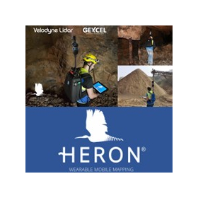
【Subsidy-Eligible Product】The 'HERON PORTABLE 3D MAPPING SYSTEM (Backpack-type Laser Scanner)' is equipped with two laser scanners oriented horizontally and vertically, allowing for the acquisition of 360-degree point cloud data simply by walking. It simultaneously captures Full HD video (1920×1080 pixels / 15fps) while scanning, and for areas requiring high-resolution images, it can stop to take 5K still images (5640×2820 pixels). The tablet device in hand displays 3D data in real-time, enabling measurements while confirming that data is being accurately captured, making it a backpack-type 3D laser scanner. 【Features】 ■ Lightweight ■ Time and cost-saving ■ Usable indoors and outdoors ■ Real-time 3D measurement ■ Easy setup ■ Walking measurement capability ■ Easy tablet verification ■ Simple software processing *For more details, please refer to the PDF document or contact us directly. ★ This product is a surveying instrument eligible for "subsidy utilization" upon purchase. It may be available for purchase at 1/2 to 1/3 of the regular price! If you are interested, please feel free to contact us.
Added to bookmarks
Bookmarks listBookmark has been removed
Bookmarks listYou can't add any more bookmarks
By registering as a member, you can increase the number of bookmarks you can save and organize them with labels.
Free membership registration
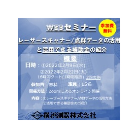
This seminar is aimed at those who want to learn about laser scanners, point clouds, and specific examples of these topics. Additionally, we will introduce the "subsidy system (business restructuring subsidy and manufacturing subsidy)." This is a free web seminar. ■ Date and Time: February 9, 2022 (Wednesday) 16:00 - 17:00 (Application deadline: by February 8 at 12:00) February 22, 2022 (Tuesday) 16:00 - 17:00 (Application deadline: by February 21 at 12:00) *Two sessions are planned. ■ Participation Fee: Free ■ Participants: 15 people (first-come, first-served) ■ Participation Method: Zoom (invitation only) ■ Content: What is a laser scanner? What is point cloud data? Specific examples of utilization Information on the two subsidies Application support from Yokohama Measuring Instruments Q&A session The content is designed to be easy to understand for those hearing about it for the first time, so please join us. *If you have any questions, please feel free to ask. *Please note that the seminar may be canceled. → If it is canceled, individual explanations can also be provided. Please apply using the URL below.
Added to bookmarks
Bookmarks listBookmark has been removed
Bookmarks listYou can't add any more bookmarks
By registering as a member, you can increase the number of bookmarks you can save and organize them with labels.
Free membership registration
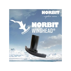
The NORBIT multi-beam sonar system "WINGHEAD" is a compact, lightweight, ultra-high-resolution narrow multi-beam sonar that employs a cylindrical receiving array. Like the iWBMS series, it incorporates an IMU from Applanix (OceanMaster) and a surface sound velocity sensor. With a beam width of 0.5° x 0.9° and 1024 beams, it can obtain ultra-high-resolution depth measurement data. It is suitable for shallow and deep surveying, sediment measurement, waterway surveying, and structural exploration, as it can acquire ultra-high-resolution 3D data. 【Features】 ■ Integrated multi-beam sonar, motion sensor, and sound velocity sensor ■ Selectable frequency between 200–700 kHz ■ Wide measurement range with a swath width of 7° to 210° ■ Beam width of 0.5° x 0.9° ■ Number of beams: 1024 (256, 512, or 1024 selectable EA&ED) *For more details, please refer to the PDF document. ★ This product is a surveying instrument eligible for "subsidy utilization" upon purchase. It may be available for purchase at 1/2 to 1/3 of the regular price! If you are interested, please feel free to contact us.
Added to bookmarks
Bookmarks listBookmark has been removed
Bookmarks listYou can't add any more bookmarks
By registering as a member, you can increase the number of bookmarks you can save and organize them with labels.
Free membership registration
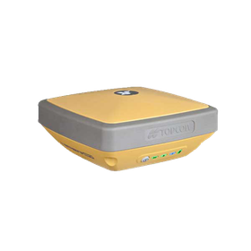
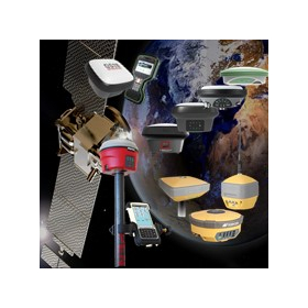
We would like to introduce the "GNSS surveying equipment" products that we handle. We offer products such as the Leica "GS18I," PENTAX "G6J2," and TOPCON "HYPERSR." 【Lineup】 ■Leica ・GS18I ・GS18T ・GS16 ・GS07 ■PENTAX ・G6J2 ■TOPCON ・HYPER SR ・HYPER V ・HYPER HR And more are available. *For more details, please refer to the PDF document or feel free to contact us.
Added to bookmarks
Bookmarks listBookmark has been removed
Bookmarks listYou can't add any more bookmarks
By registering as a member, you can increase the number of bookmarks you can save and organize them with labels.
Free membership registration
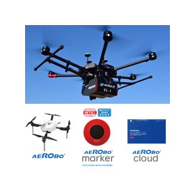
We would like to introduce the "UAV Laser Scanner and Photogrammetry" products that we handle. We offer products from AeroSense, including the PENTAX UAV laser scanner "UL-1," as well as "AeroBo," "AeroBo Marker," and others. 【Product Lineup】 ■PENTAX ・UL-1 ■AeroSense ・AeroBo ・AeroBo Marker ・AeroBo Cloud and more. *For more details, please refer to the PDF document or feel free to contact us.
Added to bookmarks
Bookmarks listBookmark has been removed
Bookmarks listYou can't add any more bookmarks
By registering as a member, you can increase the number of bookmarks you can save and organize them with labels.
Free membership registration
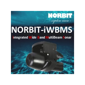
The product eligible for subsidies, 'NORBIT-iWBMS High-Resolution Narrow Multi-Beam Sonar,' is a high-resolution narrow multi-beam acoustic depth sounder that integrates a compact, high-resolution curved array seabed mapping system sonar unit (transducer), an inertial measurement unit (IMU), and a surface water sound velocity sensor (SV). It is based on a flexible sonar platform utilizing the latest analog and digital signal processing. The high-end sonar equipped with Applanix WaveMaster II (a global GNSS/INS system) enables rapid and reliable mobilization and the highest quality soundings for surveys under any conditions. **Features** - Integrated multi-beam sonar, motion sensor, and sound velocity sensor - Ability to select any frequency between 200-700 kHz - Wide measurement range with a swath width of 7° to 210° *For more details, please refer to the PDF documentation or feel free to contact us.* ★ This product is a surveying instrument eligible for "subsidy utilization" upon purchase. It may be available for purchase at 1/2 to 1/3 of the regular price! If you are interested, please do not hesitate to contact us.
Added to bookmarks
Bookmarks listBookmark has been removed
Bookmarks listYou can't add any more bookmarks
By registering as a member, you can increase the number of bookmarks you can save and organize them with labels.
Free membership registration
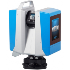
The "PENTAX Z+F IMAGER 5016 Laser Scanner" achieves high precision and high scan rates with low range noise without compromising on advantages, while being equipped with advanced HDR camera features, an integrated navigation system, and high-speed Wi-Fi, all in a compact and lightweight design! Standard LED lights are included for color photography in dark environments (capable of illuminating up to 10m). Equipped with high-speed Wi-Fi, it enables real-time data transfer to a Tablet PC using the included IMAGER5016 dedicated software 'LC SCOUT'! It allows for simultaneous verification of 3D point cloud data during measurement, significantly improving productivity. 【Features】 ■ Achieves 3D reality capture in a short time ■ Portable design that can be stored in a backpack *For more details, please refer to the PDF materials or feel free to contact us. ★ This product is a surveying instrument eligible for "subsidy utilization" upon purchase. It may be available for purchase at 1/2 to 1/3 of the regular price! If you are interested, please do not hesitate to contact us.
Added to bookmarks
Bookmarks listBookmark has been removed
Bookmarks listYou can't add any more bookmarks
By registering as a member, you can increase the number of bookmarks you can save and organize them with labels.
Free membership registration
This seminar is a free online event aimed at businesses considering the introduction of cutting-edge surveying equipment using subsidies. It will introduce the "Overview and Utilization Methods of the Subsidy System (Business Restructuring Subsidy and Monozukuri Subsidy)." 【Subsidy Utilization WEB Seminar】 ■ Dates: August 3rd and 17th ■ Time: 16:00 - 17:30 ■ Content: How to utilize subsidies? : Overview and comparison of the two subsidies : Points for subsidy application and review : Introduction of subsidy utilization case studies : Q&A session Experts certified by the government will provide full support! Even if you have never dealt with subsidies before or are unsure about what a business plan is, please feel free to participate. *You can apply through the link below.
Added to bookmarks
Bookmarks listBookmark has been removed
Bookmarks listYou can't add any more bookmarks
By registering as a member, you can increase the number of bookmarks you can save and organize them with labels.
Free membership registration
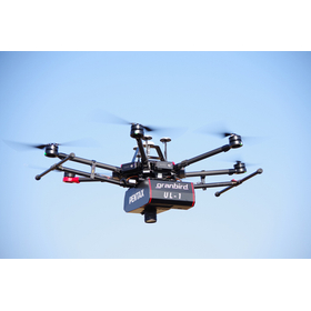
The "UL-1" is a UAV and laser surveying system capable of high-precision three-dimensional modeling of numerical terrain models and large-scale numerical topographic maps. Laser surveying and aerial photogrammetry are complemented by synchronization/hybridization through IMU. Aerial photogrammetry for map creation is easily realized with UAVs. It demonstrates cost performance in mapping areas that include urban and forested regions. It is equipped with a long-range scanner and a full-size sensor DSLR camera. 【Features】 ■ High-rate GNSS/IMU sensors ensure precise position and orientation ■ Scanning width of 300m from a ground height of 150m ■ Workflow between the field and computer ■ Significant reduction in the number of GCPs ■ Built-in DSLR camera with a full-size sensor *For more details, please refer to the catalog or PDF materials, or feel free to contact us. ★ This product is a surveying instrument that can utilize "subsidy support" upon purchase. It may be available for purchase at 1/2 to 1/3 of the regular price! If you are interested, please do not hesitate to contact us.
Added to bookmarks
Bookmarks listBookmark has been removed
Bookmarks listYou can't add any more bookmarks
By registering as a member, you can increase the number of bookmarks you can save and organize them with labels.
Free membership registration
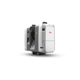
We would like to introduce our product, the 'TLS (Terrestrial Laser Scanner)'. Our lineup includes high-end models such as Leica's "Scan Station P Series" and PENTAX's "S-3180V," as well as the "RTC360," which allows for targetless point cloud synthesis, and the market's smallest and lightweight model, the "BLK360." We also offer accessory options, so please use them according to your needs. 【Lineup】 ■Scan Station P Series ■RTC360 ■BLK360 ■Multi Station MS60 ■Z+F IMAGER5016 ■PENTAX S Series *For more details, please refer to the catalog or PDF materials, or feel free to contact us.
Added to bookmarks
Bookmarks listBookmark has been removed
Bookmarks listYou can't add any more bookmarks
By registering as a member, you can increase the number of bookmarks you can save and organize them with labels.
Free membership registration